
Alexander Black

Alexander Black (fl. c. 1887 - 1900) was a cartographer and the Surveyor General of the Colony of Victoria in Australia.
Defending Victoria against rival colonial powers.
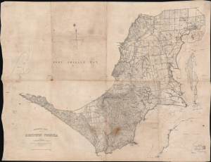
Contour Map of Mornington Peninsula.
$3,500.00
Acquire
- Digital Map Information
- Suitable for large format printing
- Full resolution TIFF file
- ICC color profile embedded
- Delivered instantly via download link
This is a rare 1891 Alexander Black map of the Mornington Peninsula near Melbourne, Australia, prepared for the use of the 'Defence Department of the Colony of Victoria'. It is primarily a topographical map but also offers comprehensive information about the peninsula and its defensive potential - increasingly significant in the face of a proactive German effort to establish a colonial presence in the Pacific. It was printed directly on waxed linen, suggesting it was meant for field use, as this material resists dampness and withstands repeated folding and unfolding. (more details)