
Blondel la Rougery, Edouard

Blondel la Rougery was a French publishing house founded in Paris around 1902 by the publisher and aerophile Édouard Blondel la Rougery (July 9, 1877 - July 20, 1955). The company specialized in maps and books, particularly those related to aviation and maritime themes. Over time, Blondel la Rougery became well-known for its detailed maps, which were used extensively during both World Wars. In 1934, the firm inherited the aviation and cartographic copyrights of Georges Besançon (1866 - 1934), erstwhile publisher of L'Aérophile. In 1955, his son Max Blondel la Rougery took over the business and continued to manage it until 1976. The company continued to operate until the early 21st century, with its focus remaining largely on map production. The publisher’s works are notable for their precision and artistic quality, making them highly regarded in both historical and cartographic circles.
Romanticizing the French Riviera.
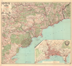
Carte Touristique de Cannes et des environs Massiv de L'Estérel.
$800.00
Acquire
- Digital Map Information
- Suitable for large format printing
- File Size: 104.58 MB
- File Type: ZIP / TIFF
- ICC color profile embedded
- Delivered instantly via download link
A spectacular c. 1920 large-scale chromolithograph map of the French Riviera by Blondel la Rougery. The map, a lavish production meant to highlight the Cannes region for tourists, was issued as part of the Syndicat d'Initiative de Cannes's ongoing and outrageously successful mission to turn the French Riviera into a playground for the elite. Its issue corresponds with the Rivera's, and specifically Cannes', emergence as a mecca for the intelligentsia, hosting Scott and Zelda Fitzgerald, Pablo Picasso, Francis Picabia, and Jean Cocteau, among countless others. (more details)
Occupied Paris.
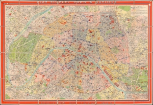
Plan Blondel Paris et Banlieue.
$950.00
Acquire
- Digital Map Information
- Suitable for large format printing
- Full resolution TIFF file
- ICC color profile embedded
- Delivered instantly via download link
This is a c. 1942 Editions Blondel la Rougery city plan or map of Paris, France. The map illustrates Paris during the World War II (1939 - 1945) Nazi occupation. The name on the back, Capt. Franklin G. Fischrist (or possibly Tischrist), suggests it was used by an English or American officer after the war. (more details)
Remembering the beauty of a city devastated by World War II.
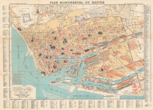
Plan Monumental du Havre.
$250.00
Acquire
- Digital Map Information
- Suitable for large format printing
- File Size: 34.04 MB
- File Type: ZIP / TIFF
- ICC color profile embedded
- Delivered instantly via download link
This is a 1948 Blondel la Rougery and Imprimerie Gaillac-Monrocq pictorial map of Le Havre, France. Published within a few years of the end of World War II (1939 - 1945), this map acts more as a summary of all the history that was lost during the war than as a practical guide to getting around the city. (more details)