
Bremner, John

John Bremner (18XX-18XX) was an officer of the British Navy, and a hydrographer. Between 1824 and 827 he served as master aboard HMS Mersey, during that ship's posting to the South America Station of the British Navy. He is known to have produced a handful of manuscript sketches and charts connected with that voyage; one at least was preserved in print (Sketch of the Bay of Santa and Port Samanca on the Coast of Peru 1826) No other part of his life, education or career is known.
British mapping of the Peruvian coast during the Bolivar Regime.
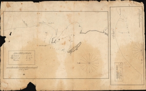
The Port of Santa. / Pacasmayo Roads.
$1,500.00
Acquire
- Digital Map Information
- Suitable for large format printing
- File Size: 4.9 MB
- File Type: ZIP / TIFF
- ICC color profile embedded
- Delivered instantly via download link
These two c. 1927 manuscript maps, drawn on a single sheet, detail anchorages along the coast of Peru: one of the Island of Santa and the approaches to Pacasmayo. They were taken from the 1824-27 voyage of HMS Mersey during the ship's tenure in South America and were likely the work of either her Captain or her Master. (more details)