
Caspar, Charles Nicholas

Charles Nicholas Caspar (October, 1854 - 1928), also known as Carl, was a German-American bookseller, antiquarian bookseller, and publisher based in Milwaukee, Wisconsin. Caspar was born in Germany and emigrated to the United States in 1868, becoming a citizen in 1878. Under the imprint of 'C. N. Caspar Company', he published maps, atlases, postcards, and touristic brochures. Most of his cartographic work is local in nature and focuses on Milwaukee and the immediate vicinity. The firm also did considerable business in German language material. The retail outlet was called C. N. Caspar Company Book Emporium and located at 454 East Water St., Milwaukee.
Beer Capital of the World.
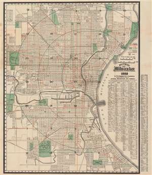
Map of the City of Milwaukee.
$650.00
Acquire
- Digital Map Information
- Suitable for large format printing
- Full resolution TIFF file
- ICC color profile embedded
- Delivered instantly via download link
A dramatic and scarce 1909 city plan or map of Milwaukee, Wisconsin by the C. N. Caspar Company. The map illustrates the city during a period of rapid growth and industrialization, spurred in large part by the brewing industry, which earned the city the nickname ‘Beer Capital of the World’. (more details)
The 'Official' map.
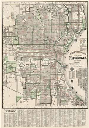
Caspar's Official Map of the City of Milwaukee and Vicinity.
$400.00
Acquire
- Digital Map Information
- Suitable for large format printing
- File Size: 48.24 MB
- File Type: ZIP / TIFF
- ICC color profile embedded
- Delivered instantly via download link
A fine example of the 1916 first edition of Carl / Charles N. Caspar's 'Official' map of Milwaukee, Wisconsin. This lithograph map covers from Shorewood to Humboldt Park and from Lake Michigan westward as far as the National Soldier's Home and Calvary Cemetery. Green and red overprinting illustrate city wards, electrical lines, and parks. The map further notes streets, house number, railroads, electric car lines, parks, steam railways, section numbers, rivers and even the 'bathing pavilion.' A comprehensive index appears below the map. (more details)