
Clerot, Victor

Victor Clérot (fl. 1855 - 1890) was a Paris based geographer and publisher active in the latter half of the 19th century. As with most small volume French map publishers of this period there is very little available information regarding Clérot. We know he published several maps of Paris, a world map, some timelines, and a number of guidebooks, but little else. His offices were located at 23 Quai Malaquais in Paris's 6th Arrondissement.
Paris emerging as a modern European capital.
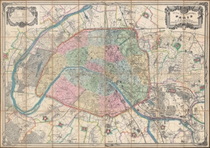
Nouveau plan géométrique de Paris et ses environs.
$3,000.00
Acquire
- Digital Map Information
- Suitable for large format printing
- File Size: 184.63 MB
- File Type: ZIP / TIFF
- ICC color profile embedded
- Delivered instantly via download link
This is an impressive 1873 Victor Clérot city plan or map of Paris, measuring nearly 5 feet wide. In 1873, Paris was in the midst of recovery and transformation, still bearing the scars of the Franco-Prussian War and the Commune of 1871. The Third Republic was consolidating its power, establishing a more stable and democratic government, setting the stage for Paris's resurgence as a center of cultural and intellectual activity in Europe. It also illustrates the Theirs Wall and the city's impressive, if short-lived, fortifications. (more details)