This item has been sold, but you can get on the Waitlist to be notified if another example becomes available, or purchase a digital scan.
1852 Clérot Universal Human History Timeline Chart
Cosmorama-clerot-1852$1,250.00

Title
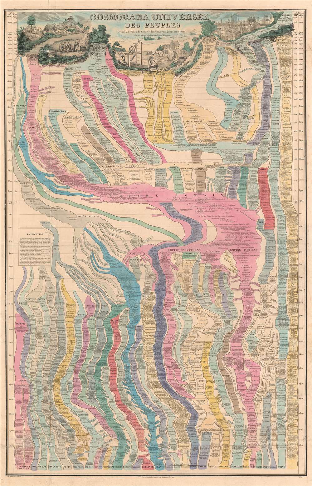
Cosmorama Universel des Peuples depuis la Création du Monde, et leurs Marches jusqu'à nos jour.
1852 (undated) 39 x 25.25 in (99.06 x 64.135 cm)
1852 (undated) 39 x 25.25 in (99.06 x 64.135 cm)
Description
A marvelously complex c. 1852 universal timeline chart by the French cartographer Victor Clérot. The chart traces human history from creation, roughly, to the founding of the Roman Empire. The cartographer follows the Usher Chronology, placing the date of Creation at 4004 BC with the Biblical Deluge at about 2300 BC. The chart then proceeds to break down history in 100-year increments. After 3984 years, Jesus Christ is born, and standard BC/AD dating system is adopted to 1800.
Breaking it all down
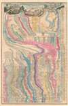
From the upper graphic, the left of which illustrates the Garden of Eden, Noah's Ark, and ancient sacrifices, and the right, the architectural accomplishments of the ancients, time flows like a river from various geo-cultural roots: Ancient Greece, Asia Minor, Germany, Egypt, and China. A separate flow of time illustrates inventions, celebrities, and discoveries. After Several thousand years, much is consolidated in the Roman Empire, which appears as a pink sea at center. German and Sarmate tribes are separated to the left. From these roots, most modern nations evolve. China follows a unique separate path from the earliest days. American history here begins around 900 AD, with the Dane Gunnbjörn Ulfsson's discovery of Greenland. The final event identified on this chart is the establishment of the French Second Empire in 1852.Publication History and Census
There appear to have been several editions issued by various publishers. The earliest was published by Armand Joseph Lallemand on blue ink, around 1841. The present example, issued by Victor Clérot, was printed by Imp. Mangeon (Rue St. Jacques, 67). Ironically, given that it is a time chart, this item has no date. Nonetheless, it features events to the establishment of the Second French Empire, 1852.Further Publication History
We are aware of only single example of the 1841 Lallemand issue - at the Bibliothèque Nationale de France, which, also undated, terminates at the reign of Louis Philippe I (1773 -1850). Although the c. 1852 Victor Clérot issue, offered here, is listed in the OCLC, no institutional holdings are identified and no market history.CartographerS
Victor Clérot (fl. 1855 - 1890) was a Paris based geographer and publisher active in the latter half of the 19th century. As with most small volume French map publishers of this period there is very little available information regarding Clérot. We know he published several maps of Paris, a world map, some timelines, and a number of guidebooks, but little else. His offices were located at 23 Quai Malaquais in Paris's 6th Arrondissement. More by this mapmaker...
Armand Joseph Lallemand (c. 1810 - 1871) was an engraver and map publisher based in Paris during the mid-19th century. Most of Lallemand's work focused on landscapes and building vies, though he did take part in a few cartographic ventures, including the production of an atlas with Alexandre Emile Lapie and several tourist pocket maps of Paris. Learn More...
Condition
Very good. Some toning and wear on original fold lines. Splits reinforced and repaired on verso.
References
Bibliothèque Nationale de France, GE C-8689. OCLC 558040830.