
Cloos, George W.

George W. Cloos (May 8, 1887 - October 1, 1927) was a German-American civil engineer and real estate insurance appraiser active in Milwaukee, Wisconsin, in the early 20th century. Cloos was born in Milwaukee to German immigrant parents. Cloos compiled several regional atlases and maps in partnership with fellow German-American Carl / Charles N. Caspar.
The 'Official' map.
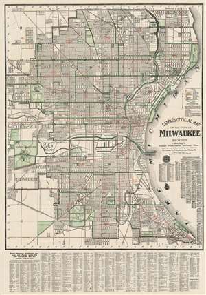
Caspar's Official Map of the City of Milwaukee and Vicinity.
$400.00
Acquire
- Digital Map Information
- Suitable for large format printing
- File Size: 48.24 MB
- File Type: ZIP / TIFF
- ICC color profile embedded
- Delivered instantly via download link
A fine example of the 1916 first edition of Carl / Charles N. Caspar's 'Official' map of Milwaukee, Wisconsin. This lithograph map covers from Shorewood to Humboldt Park and from Lake Michigan westward as far as the National Soldier's Home and Calvary Cemetery. Green and red overprinting illustrate city wards, electrical lines, and parks. The map further notes streets, house number, railroads, electric car lines, parks, steam railways, section numbers, rivers and even the 'bathing pavilion.' A comprehensive index appears below the map. (more details)