
Doetecum, Joannes van

Joannes van Doetecum the Elder (1530 - 1605) was a Dutch engraver and cartographer, known for his etchings after Breughel, and an array of maps engraved on his own behalf and that of an array of cartographers. He was born in Deventer, and moved to Haarlem in 1578. He was the start of a dynasty of Dutch map engravers whose work appears on the maps of Gerard De Jode, Abrahanm Ortelius, Jan van Linschoten, Plancius, Plantin, Waghanaer, Jansson, and Visscher. His engraver family included his brother Lucas (fl. 1558 - 1593,) and his sons Johannes II )(fl. 1592-1630) Peter, and Baptista. Despite their prolific work, very little is known about the Doetecum family.
Heart of the Dutch Revolt.
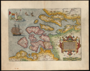
Zelandicarum Insularum Exactissima et Nova Descriptio, Auctore D. Iacobo A Daventria.
$850.00
Acquire
- Digital Map Information
- Suitable for large format printing
- Full resolution TIFF file
- ICC color profile embedded
- Delivered instantly via download link
This is a beautiful example of Abraham Ortelius' 1570 map of the Zeeland province of the Netherlands. The province was inclusive of Antwerp, where Ortelius lived and worked, thus presenting the mapmaker's homeland. It is, moreover, the best map of the lands at the heart of the Dutch Revolt and Eighty Years’ War (1568 - 1648). (more details)
First atlas map of the Duchy of Milan.
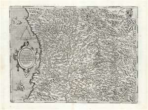
Ducatus Mediolanensis, Finitimarumque Regionū Descriptio,, Auctore Joanne Georgio Septala Mediolanense.
$450.00
Acquire
- Digital Map Information
- Suitable for large format printing
- DPI: 600
- File Size: 55.34 MB
- File Type: ZIP / TIFF
- ICC color profile embedded
- Delivered instantly via download link
This is Abraham Ortelius' 1570 map of the Duchy of Milan, in Italy. It was based the map of Giovanni Giorgio Settala (1520 - 1590) engraved by Hieronymus Cock, which exists in a sole copy in the British Library. Settala was Milanese, and although most of his life was spent building fortifications for Charles V in Spain, his map was drawn while he lived in Milan. (more details)
Revealing Portuguese Secrets of the East.
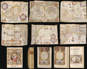
Histoire de la Navigation. / Le Grand Routier de Mer. / Description de l'Amerique.
$65,000.00
Acquire
This is a beautiful, lavishly illustrated and colored, 1638 French-text edition of one of the most important and influential geographical works: Jan Huygen van Linschoten's Itinerario. More than any other text, Linschoten's assemblage of charts, sailing instructions, and sociological observations revealed - first to the Dutch, then to the rest of Europe - the path to the Spice Islands of the East Indies. This book was instrumental in breaking the Portuguese monopoly on the East India trade, and led directly to Dutch supremacy in world trade. Its significance was recognized immediately, and Dutch trading companies supplied copies to each ship sailing east. The Dutch owe their Golden Age of the 17th century to the secrets Linschoten revealed in this work. (more details)