
1638 Jan van Linschoten <i>Itinerario</i> in its full French Folio Edition

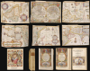
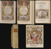
Histoire de la Navigation. / Le Grand Routier de Mer. / Description de l'Amerique.
Revealing Portuguese Secrets of the East.
Revealing Portuguese Secrets of the East.
This is a beautiful, lavishly illustrated adn colored, 1638 French-text edition of one of the most important and influential geographical works: Jan Huygen van Linschoten's Itinerario. More than any other text, Linschoten's assemblage of charts, sailing instructions, and sociological observations revealed - first to the Dutch, then to the rest of Europe - the path to the Spice Islands of the East Indies. This book was instrumental in breaking the Portuguese monopoly on the East India trade, and led directly to Dutch supremacy in world trade. Its significance was recognized immediately, and Dutch trading companies supplied copies to each ship sailing east. The Dutch owe their Golden Age of the 17th century to the secrets Linschoten revealed in this work.A Closer Look
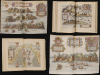
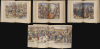
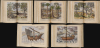
This French edition consists of three volumes bound together: Linschoten's Histoire de la Navigation, his Routier de Mer, and his Description de l'Amerique. Each volume has its own engraved title page and pagination. An important distinction of this edition is that, rather than the reduced-format plates engraved for the French edition of 1610, this third French edition presented the more desirable folio-sized plates used in the original Dutch editions of the work, engraved by the Doetechum family.Histoire de la Navigation, the first volume, consists of the French translation of Linschoten's Itinerario. The text describes Linschoten's journeys to and from Goa, but it lingers on detailing the peoples, customs, costumes, flora, and fauna of the Far East. The work's rich detail comes largely from Linschoten's firsthand experience as a clerk to the Archbishop of Goa, the center of Portuguese power in the East. To this volume belong Linschoten's 36 engravings, panoramas, and town plans - many drawn by the author himself. Mainly, these depict the styles and customs of both denizens and visitors to Goa, as well as the types of ships used in the India trade; there are also plates dedicated to accurately depicting the spices and fruits found in the East, and the manner of their cultivation.
The second volume - less visually striking, but historically more significant - is Linschoten's collected sailing instructions for reaching the East Indies. Though bound as the second volume here, it was actually the first volume of the work to be published in 1595. It was derived from the roteiro of the Portuguese Royal pilot Diego Alfonso, containing practical sailing instructions for reaching India from Portugal, and then sailing from India to the East Indies. While Linschoten's personal observations in his Itinerario had great sociological (and entertainment) value, this set of instructions was the key the Dutch used to unlock Portugal's hold on the East India trade.
The third volume, Description de l’Amerique, provides an account of America and the African coast.
The Maps
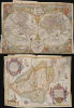
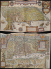
The six large and beautifully engraved folding maps for which Linschoten's book is most esteemed are interspersed throughout the text:- World: Orbis terrarum typus de integro multis in locis emendatus. - Petrus Plancius 1594. A groundbreaking work, this is the first printed map to include a decorative allegorical surround. Engraved by the Dutch master Jan van Doetecum.
- South America and the Caribbean: Delineatio omnium orarum totius Australis partis Americae, dictae Peruvianae, à R. de la Plata, Brasiliam, Pariam, et Castellam auream… - By far the best map of South America to appear in the 16th century. Engraved and designed by Arnold Florent van Langren.
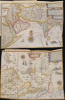
- East and Southeast Asia: Exacta et accurata delineatio cum orarum maritimarum tum etiam locorum terrestrium quae in regionibus China, Cauchinchina, Camboja sive Champa, Syao, Malacca, Arracan et Pegu… - Groundbreaking chart of China, Japan, Korea, Southeast Asia, the Philippines, the Straits of Malacca, Borneo, Java, and Beach. Engraved by Henricus Van Langren (son of Arnold Floris van Langren).
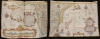
- West Africa and the South Atlantic: Typus orarum maritimarum Guineae, Manicongo, et Angolae ultra promontorium Bonae Spei… - Covering Africa from Guinea to South Africa, this is one of the greatest maps of any part of hte continent from the 16th century. Engraved in the Flemish style by Arnold Florent van Langren.
- East Africa, Madagascar, and the Western Indian Ocean: Delineatio orarum maritimarum, terrae vulgo indigetatae Terra do Natal, item Sofalae, Mozambicae, et Melindae… - This is one of the greatest maps of any part of hte continent from the 16th century. Engraved in the Flemish style by Arnold Florent van Langren.
- Arabia, Persia, and India: Deliniantur in hac tabula, orae maritimae Abexiae, freti Mecani; al. Maris Rubri; Arabiae, Ormi, Persiae… - Coverage embracing from the Arabian Peninsula to Sumatra, this map offers one of the most detailed early modern views of the Indian Ocean trading routes. Engraved by Henricus Van Langren (son of Arnold Floris van Langren).
Unparalleled Access
Linschoten, a secretary to the Archbishop of Goa between 1583 and 1589, was uniquely positioned to collect information pertinent to the Portuguese empire, which he promptly published upon his return to the Netherlands. His Itinerario's description of the lands of the East, and the different peoples his employers encountered, their costumes, religions and customs, represented the bulk of his work. However, his copying of Portuguese sea charts, sailing instructions, and port-to-port guides proved a thunderbolt for the Dutch, who swiftly used the new information to seize control of the lucrative spice trade. Linschoten's book is scarcely rivaled in its historical impact. Without Itinerario, the Dutch would have been far less able to break the Portuguese monopoly on the East Indian trade, and the Dutch Golden Age would likely not have occurred.Publication History and Census
This 1638 edition of Linschotens' book was published in Amsterdam by Evert Cloppenburgh. The plates and maps were engraved by Johannes van Doetechum and his sons, Johannes the Younger and Johannes Baptista, as well as Arnold Floris van Langren and his son, Henricus Van Langren, for inclusion in the 1596 Dutch edition of Linschoten's Itinerario, voyage ofte schipvaert van Jan Huygen Van Linschoten naer Oost ofte Portugaels Indien. They remained in all later editions of Linschoten's work.This is a beautiful, lavishly colored, 1638 French-text edition of one of the most important and influential geographical works: Jan Huygen van Linschoten's Itinerario. More than any other text, Linschoten's assemblage of charts, sailing instructions, and sociological observations revealed - first to the Dutch, then to the rest of Europe - the path to the Spice Islands of the East Indies. This book was instrumental in breaking the Portuguese monopoly on the East India trade, and led directly to Dutch supremacy in world trade. Its significance was recognized immediately, and Dutch trading companies supplied copies to each ship sailing east. The Dutch owe their Golden Age of the 17th century to the secrets Linschoten revealed in this work.A Closer Look
This French edition consists of three volumes bound together: Linschoten's Histoire de la Navigation, his Routier de Mer, and his Description de l'Amerique. Each volume has its own engraved title page and pagination. An important distinction of this edition is that, rather than the reduced-format plates engraved for the French edition of 1610, this third French edition presented the more desirable folio-sized plates used in the original Dutch editions of the work, engraved by the Doetechum family.Histoire de la Navigation, the first volume, consists of the French translation of Linschoten's Itinerario. The text describes Linschoten's journeys to and from Goa, but it lingers on detailing the peoples, customs, costumes, flora, and fauna of the Far East. The work's rich detail comes largely from Linschoten's firsthand experience as a clerk to the Archbishop of Goa, the center of Portuguese power in the East. To this volume belong Linschoten's 36 engravings, panoramas, and town plans - many drawn by the author himself. Mainly, these depict the styles and customs of both denizens and visitors to Goa, as well as the types of ships used in the India trade; there are also plates dedicated to accurately depicting the spices and fruits found in the East, and the manner of their cultivation.
The second volume - less visually striking, but historically more significant - is Linschoten's collected sailing instructions for reaching the East Indies. Though bound as the second volume here, it was actually the first volume of the work to be published in 1595. It was derived from the roteiro of the Portuguese Royal pilot Diego Alfonso, containing practical sailing instructions for reaching India from Portugal, and then sailing from India to the East Indies. While Linschoten's personal observations in his Itinerario had great sociological (and entertainment) value, this set of instructions was the key the Dutch used to unlock Portugal's hold on the East India trade.
The third volume, Description de l’Amerique, provides an account of America and the African coast.
The Maps
The six large and beautifully engraved folding maps for which Linschoten's book is most esteemed are interspersed throughout the text:- World: Orbis terrarum typus de integro multis in locis emendatus. - Petrus Plancius 1594. A groundbreaking work, this is the first printed map to include a decorative allegorical surround. Engraved by the Dutch master Jan van Doetecum.
- South America and the Caribbean: Delineatio omnium orarum totius Australis partis Americae, dictae Peruvianae, à R. de la Plata, Brasiliam, Pariam, et Castellam auream… - By far the best map of South America to appear in the 16th century. Engraved and designed by Arnold Florent van Langren.
- East and Southeast Asia: Exacta et accurata delineatio cum orarum maritimarum tum etiam locorum terrestrium quae in regionibus China, Cauchinchina, Camboja sive Champa, Syao, Malacca, Arracan et Pegu… - Groundbreaking chart of China, Japan, Korea, Southeast Asia, the Philippines, the Straits of Malacca, Borneo, Java, and Beach. Engraved by Henricus Van Langren (son of Arnold Floris van Langren).
- West Africa and the South Atlantic: Typus orarum maritimarum Guineae, Manicongo, et Angolae ultra promontorium Bonae Spei… - Covering Africa from Guinea to South Africa, this is one of the greatest maps of any part of hte continent from the 16th century. Engraved in the Flemish style by Arnold Florent van Langren.
- East Africa, Madagascar, and the Western Indian Ocean: Delineatio orarum maritimarum, terrae vulgo indigetatae Terra do Natal, item Sofalae, Mozambicae, et Melindae… - This is one of the greatest maps of any part of hte continent from the 16th century. Engraved in the Flemish style by Arnold Florent van Langren.
- Arabia, Persia, and India: Deliniantur in hac tabula, orae maritimae Abexiae, freti Mecani; al. Maris Rubri; Arabiae, Ormi, Persiae… - Coverage embracing from the Arabian Peninsula to Sumatra, this map offers one of the most detailed early modern views of the Indian Ocean trading routes. Engraved by Henricus Van Langren (son of Arnold Floris van Langren).
Unparalleled Access
Linschoten, a secretary to the Archbishop of Goa between 1583 and 1589, was uniquely positioned to collect information pertinent to the Portuguese empire, which he promptly published upon his return to the Netherlands. His Itinerario's description of the lands of the East, and the different peoples his employers encountered, their costumes, religions and customs, represented the bulk of his work. However, his copying of Portuguese sea charts, sailing instructions, and port-to-port guides proved a thunderbolt for the Dutch, who swiftly used the new information to seize control of the lucrative spice trade. Linschoten's book is scarcely rivaled in its historical impact. Without Itinerario, the Dutch would have been far less able to break the Portuguese monopoly on the East Indian trade, and the Dutch Golden Age would likely not have occurred.Publication History and Census
This 1638 edition of Linschotens' book was published in Amsterdam by Evert Cloppenburgh. The plates and maps were engraved by Johannes van Doetechum and his sons, Johannes the Younger and Johannes Baptista, as well as Arnold Floris van Langren and his son, Henricus Van Langren, for inclusion in the 1596 Dutch edition of Linschoten's Itinerario, voyage ofte schipvaert van Jan Huygen Van Linschoten naer Oost ofte Portugaels Indien. They remained in all later editions of Linschoten's work.Cartographers
Jan Huyghen van Linschoten (1563 - February 8, 1611) was a Dutch merchant, cartographer, and historian active in the late 16th century. He was born in Haarlem, the son of a public notary but moved to Enkhuizen shortly thereafter. In 1576, at 14, Linschouten relocated to Spain, to apprentice as a merchant under this older brother, Willem van Linschouten, then active in Seville. He remained until 1580, when he took work in Lisbon, Portugal, under another merchant. He was in this position only briefly before Willem introduced him to the Archbishop of Portuguese Goa, Dominican Vicente da Fonseca, to whom he was appointed secretary. Accompanying Vicente da Fonseca, Linschoten arrived in Goa in September of 1583. He remained under Vicente da Fonseca for the next four years, often traveling with the Archbishop to far of locations such as China and Japan. During that time, he became fascinated with Asian cultures and their interaction with Europeans. With access at the highest level, he copied numerous maps and other documents, as well as records on sea routes to and from Goa, and trade agreements. When Vicente da Fonseca died in 1587, Jan Huyghen boarded a ship back to Holland, but was waylaid en route by a pirate attack and shipwreck in the Azores, where he remained until 1592. Back in Holland, Jan Huyghen joined the 1594 expedition of Willem Barentsz to the Kara Sea, north of Russia, in search of the fabled Northeast Passage to Asia. The Barentsz expedition was a failure, but Jan Huyghen survived and back in Holland with the support of Cornelius Claesz, he published an account the voyage. He also published a journal of his travels in Asia, in the process revealing a wealth of Portuguese trade secrets which ultimately influenced Dutch and English attempts to take over the East Asia trade. Among these he revealed was the ‘key’ to unlocking the Portuguese grip on passage through the Malacca Strait. He suggested traders approach the East Indies through the Sunda Strait, thereby circumventing Portuguese patrols in Malacca. This passage eventually became the main VOC thoroughfare into Southeast Asia and led to the Dutch colonization of the East Indies. In 1595 he married Reynu Meynertsdr Seymens, also of Enkhuizen. He remained with his family in Linschoten died in Enkhuizen, where he had worked as town treasurer until his death in 1611. Further Details...
Joannes van Doetecum the Elder (1530 - 1605) was a Dutch engraver and cartographer, known for his etchings after Breughel, and an array of maps engraved on his own behalf and that of an array of cartographers. He was born in Deventer, and moved to Haarlem in 1578. He was the start of a dynasty of Dutch map engravers whose work appears on the maps of Gerard De Jode, Abrahanm Ortelius, Jan van Linschoten, Plancius, Plantin, Waghanaer, Jansson, and Visscher. His engraver family included his brother Lucas (fl. 1558 - 1593,) and his sons Johannes II )(fl. 1592-1630) Peter, and Baptista. Despite their prolific work, very little is known about the Doetecum family. Further Details...
Source
Linschoten, J. H., Histoire de la Navigation, (Amsterdam: Cloppenburgh) 1638.
Condition
Very good. Folio [12.5 x 8.5 inches], engraved title, (4) ff. including portrait. 206 pp.; (2) ff. including second title, 181 pp.; (1) f. engraved title, 79 pp. (numbered1-60; 67-86) 36 plates and 6 folding maps. Contemporary vellum over pasteboards, rebound. Mends to a few plates; occasional separation at junctures of folds. Else an excellent example.
References
OCLC 8064775. Rumsey 12236.000. Borba, R., Bibliographia Brasiliana: A Bibliographical Essay on Rare Books About Brazil Published from 1504 to 1900 490. Tiele, P. A., Nederlandsche bibliographie 686-88. Lach D. F., Asia in the Making of Europe 1.1.196-204 and 482-90. Burnell and Tiele, The Voyage of John Huyghen van Linschoten to the East Indies Hakluyt Society. Sabin, J., A dictionary of books relating to America: from its discovery to the present time, 41366. Bagrow, L., History of Cartography, fig. 59. Shirley, R.W., The Mapping of the World, p. 187.