
Dosseray, Jean

Jean Dosseray (1868 - 1904) was a Belgian publisher and editor active in Brussels during the late 19th century. He published science-based maps for schools and tourists.
The height of the Great Game.
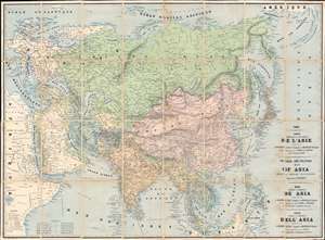
Carte Physique et Politique de l'Asie. Physical and Political Map of Asia Showing British Possessions. Mapa Físico y Político de Asia. Carta Fisica y Politica dell'Asia.
$750.00
Acquire
- Digital Map Information
- Suitable for large format printing
- Full resolution TIFF file
- ICC color profile embedded
- Delivered instantly via download link
This is an 1888 Jean Dosseray map of Asia, published at the height of the Great Game. Dosseray's map broadly covers all of Asia. It is titled in French, English, Spanish, and Italian, suggesting he intended it for a pan-European audience. Regions are identified by a mix of local and Western names, with tribes referenced in certain areas, suggesting a remarkable level of ethnic sensitivity for the period. (more details)
A beautiful map of the Pacific!
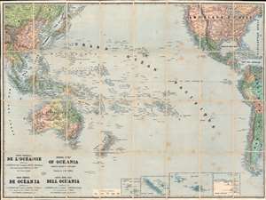
Carte Générale de l'Océanie. General Map of Oceania Showing British Possessions. Mapa Général de Océania. Carta Général dell Océania.
$700.00
Acquire
- Digital Map Information
- Suitable for large format printing
- Full resolution TIFF file
- ICC color profile embedded
- Delivered instantly via download link
This is the 1888 Jean Dosseray map of the Pacific Ocean. Composed in French (with titles in French, English, Spanish, and Italian), islands, island chains, and seas are illustrated and identified throughout. Colors highlight colonial claims of England, France, Spain, Portugal, and the Netherlands. Insets along the bottom focus on New Caledonia and the Loyalty Islands, Nuku Hiva (the largest of the Marquesas Islands in French Polynesia), Tahiti, and part of Antarctica. (more details)
European military uniforms and more.
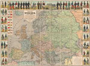
Nuevo Mapa de Europa Politico y Comercial Ilustrado con los Tipos y Uniformes Militares de los Estados de Europa.
$1,000.00
Acquire
- Digital Map Information
- Suitable for large format printing
- Full resolution TIFF file
- ICC color profile embedded
- Delivered instantly via download link
This is an 1890 Jean Dosseray wall map of Europe. A political map of Europe occupies most of the sheet, with countries, cities, towns, rivers, and more all identified. Europe's rail is highlighted, underscoring its ever-growing importance. Eighteen European flags with population statistics appear in an inset at the upper left. An inset in the lower right focuses on the Suez Canal and the Nile Delta in Egypt, underscoring the canal's strategic importance to European powers. (more details)