1888 Dosseray Map of the Pacific Ocean and Oceania
Oceania-dosseray-1888$700.00


Title
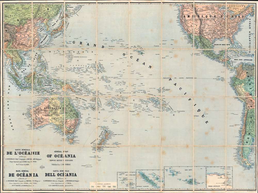
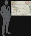
Carte Générale de l'Océanie. General Map of Oceania Showing British Possessions. Mapa Général de Océania. Carta Général dell Océania.
1888 (dated) 28.75 x 38.5 in (73.025 x 97.79 cm) 1 : 19000000
1888 (dated) 28.75 x 38.5 in (73.025 x 97.79 cm) 1 : 19000000
Description
This is the 1888 Jean Dosseray map of the Pacific Ocean. Composed in French (with titles in French, English, Spanish, and Italian), islands, island chains, and seas are illustrated and identified throughout. Colors highlight colonial claims of England, France, Spain, Portugal, and the Netherlands. Insets along the bottom focus on New Caledonia and the Loyalty Islands, Nuku Hiva (the largest of the Marquesas Islands in French Polynesia), Tahiti, and part of Antarctica.
Publication History and Census
This map was created and published by Jean Dosseray in 1888. We note a single cataloged example in OCLC, located at the University of California Santa Barbara.Cartographer
Jean Dosseray (1868 - 1904) was a Belgian publisher and editor active in Brussels during the late 19th century. He published science-based maps for schools and tourists. More by this mapmaker...
Condition
Very good. Dissected and mounted on linen in thirty-two (32) panels. Light wear along original fold lines.
References
OCLC 44143278.