
Fremin, A. R.

A. R. Fremin (fl. c. 1810 - c. 1860) was a French geographer active in the early to mid 19th century. He is known to have been a student of the cartographer Jean-Baptiste Poirson. Fremin drew and compiled maps for many prominent French cartographic publishers of the period including Tardieu, Logerot, Dufour, Monin, Duvotenay, Dyonnet, and Vuillemin. Little else is known of Fremin's life and work.
Redefining the French national identity in the Bourbon Restoration.
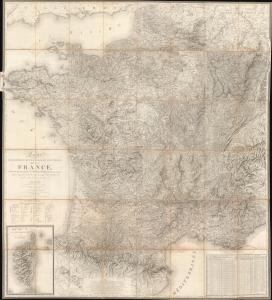
Carte Topographique, Minéralogique et Statistique de la France, Réduite de celle de Cassini, a L'Échelle de 1:388800.
$5,000.00
Acquire
- Digital Map Information
- Suitable for large format printing
- File Size: 122.13 MB
- File Type: ZIP / TIFF
- ICC color profile embedded
- Delivered instantly via download link
A massive 1826 map of France by Alexis Donnet and Hyacinthe Langlois. The map was issued as the definitive map of France during the Bourbon Restoration (1814 - 1830), as the nation recovered and reorganized in the wake of the Napoleonic Wars (1803 - 1815). (more details)