
Halma, François
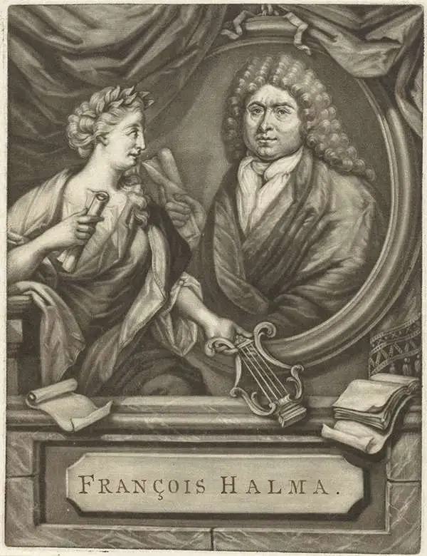
François Halma (1653 - 1722) was a Dutch publisher active in Utrecht (starting 1674) and later in Amsterdam where he worked as printer and publisher from 1699-1710. He eventually settled at Leeuwarden, where he died. His output was composed of botanical, theological and historical works, but also, he published a small number of geographies and atlases. In 1695, he published an edition of Gerard Mercator's Ptolemy. His re-issue of Schotanus à Sterringa’s Friesche Atlas in 1698 was regarded among his finest work. He also published an edition of Sanson’s Description de l’Univers. He produced an edition of Falda's plan of Rome in or around 1700. He also caused to be engraved a set of large-format maps of the continents and the world (this latter after Cassini) which are quite rare and appear to have been separately issued. We are aware of institutional copies of the continents having been bound into a 1710 Visscher atlas. The execution of these large and rare maps, drawn by Jan Goeree and engraved by Jan Baptiste, was of a very high quality. The plates were later acquired and reprinted, virtually unchanged, by Pieter van der Aa in 1713.
Baroque Masterpiece in the Mapping of America.
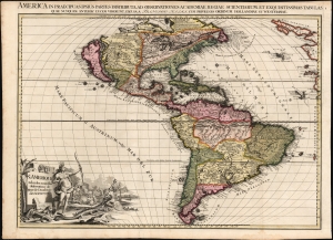
L'Amerique selon les Nouvelles Observations de Messrs. de l'Academie des Science, etc./ America in Praecipuas ipsius Partes Distributa, ad Observationes Academiae Regiae Scientiarum, et Exquisitissimas Tabulas, quae nunquam Antehac Lucem Viderunt, Excusa A Francisco Halma, Cum privilegio Ordinum Hollandiae et Westfrisiae.
$6,000.00
Acquire
- Digital Map Information
- Suitable for large format printing
- Full resolution TIFF file
- ICC color profile embedded
- Delivered instantly via download link
This is the rare first state of François Halma's c. 1699 separately-issued map of America. Its unusually large folio size, bold and sophisticated engraving, and rich original color set this map apart as one of the most beautiful late-17th-century maps of the Americas available to the collector. It dramatically presents some of the most notable geographic ideas of its era, including a prominent insular California after the Sanson model. The Great Lakes and the course of the Mississippi, as well as the rest of the American coastline, closely resembles that of Nicolas de Fer's 1699 L'Amerique. (more details)
Baroque Masterpiece in the Mapping of Asia.
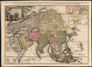
L'Asie selon les nouvelles Observations de Messrs. de l'Académie Royale des Sciences, etc./ Asia in praecipuas ipsius partes distributa, ad observationes academiae regiae scientiarum, et exquisitissimas tabulas, quae nunquam antehac lucem viderunt, Excusa A Francisco Halma, cum privilegio ordinum Hollandiae et westfrisiae.
$3,500.00
Acquire
- Digital Map Information
- Suitable for large format printing
- Full resolution TIFF file
- ICC color profile embedded
- Delivered instantly via download link
This is the rare first state of François Halma's c. 1699 separately issued map of Asia. Its unusually large folio size, bold and sophisticated engraving, and rich original color set this map apart as one of the most beautiful late-17th-century maps of the continent. (more details)
Baroque Masterpiece in the Scientific Mapping of The World.
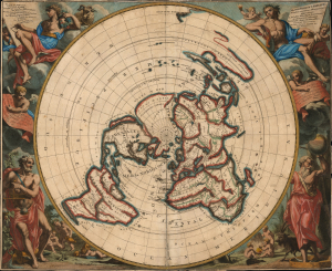
Planisphere terrestre: suivant les nouvelles observations des astronomes.../ Planispherium terrestre: secundum recentiores astronomorum observationes...
$4,250.00
Acquire
- Digital Map Information
- Suitable for large format printing
- File Size: 34.28 MB
- File Type: ZIP / TIFF
- ICC color profile embedded
- Delivered instantly via download link
This beautiful north polar projection map of the world, published in 1713 by Pieter van der Aa, is the most attractive depiction of a lost cartographic monument: Giovanni Domenico Cassini's eight-meter world map, which at one time adorned the floor of the Paris Observatory. That mammoth work can be considered the earliest scientific map of the world: it was the first to fix longitude based upon accurate astronomical observation. The present map is a glorious work of baroque art, embellished by the masterful decorative engravings of Gilliam van der Gouwen, based on the drawings of Jan Goeree. (more details)