
Ides, Eberhard Isbrand

Eberhard Isbrand Ides (1657 - 1708) was a Dutch - Danish merchant, traveler and diplomat. Little is known of his youth and education, but by 1677 he was trading with, and traveling to Russia; it is known that in 1687 he had settled in the German Quarter of Moscow. Following the 1689 Treaty of Nerchinsk, he accompanied a Russo-German embassy to Kangxi China, in order to develop trade relations between the two empires. After returning, he engaged in projects modernizing Russia's military and Navy, eventually becoming a commissioner of the Russian Admiralty, and an administrator of export tariffs for the port of Arkhangelsk. His travels to China were aided by a Russian map of East Asia supplied him by Nicolas Witsen, which the Dutch scholar-statesman hoped Ides would correct; he would soon have his own information to add, being one of the first Europeans to describe the Gobi Desert firsthand. In 1704 which included his map. Different editions of Ides' Dreyjährige Reise nach China featured examples of the map engraved by an array of mapmakers: Halma did one of the Dutch editions and an English one; the Frankfurt edition of 1707 included a map engraved by Homann.
Ides, not Izmailov.
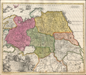
Generalis totius imperii Moscovitici...
$750.00
Acquire
- Digital Map Information
- Suitable for large format printing
- File Size: 23.27 MB
- File Type: ZIP / TIFF
- ICC color profile embedded
- Delivered instantly via download link
This is Eberhard Isbrand Ides' map of the Russian Empire in Asia, revised and engraved in 1707 by Johann Baptist Homann. Ides produced the map in 1704 to accompany the travelogue of his experiences in 1692 as an envoy sent by Peter the Great to Kangxi China in the wake of the 1689 Treaty of Nerchinsk. Although Ides credited his map to Nicolaes Witsen, the present work is more reflective of Russian cartography at the end of the 17th century than Witsen's cartography. Homann's revision of the map - placing it on a conic projection, a sophistication lacking in the Ides - sets this map apart both from its source and from other contemporaneous maps of the region. (more details)
Rare Glimpse of the Efforts to Comprehend Northeastern Asia.
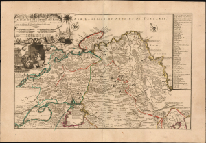
Les etats du Czar ou Empereur des Russes en Europe et en Asie...
$3,000.00
Acquire
- Digital Map Information
- Suitable for large format printing
- File Size: 38.72 MB
- File Type: ZIP / TIFF
- ICC color profile embedded
- Delivered instantly via download link
This large, beautiful, and rare map of the Russian Empire, engraved by Nicolas de Fer and published in 1722, is a fascinating revision of Nicolas Witsen's 1687 map of the Tatar Empire and Siberia. It incorporates the novel reports of Evert Ysbrandzoon Ides - derived from his journeys between Moscow and China - as well as the Central Asian voyage of Philippe Avril. (more details)