
Institutul Geografic al Armatei

Institutul Geografic al Armatei (1895 - c. 1940) was the official geographical surveying, mapping, and publishing arm of the Romanian Army. It was organized in 1895 to complete a comprehensive series of national surveys, which is published between 1900 and 1905.
Between Bucharest and Brașov.
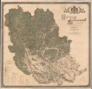
Harta Topografica Judetului Prahova.
$1,500.00
Acquire
- Digital Map Information
- Suitable for large format printing
- File Size: 232.7 MB
- File Type: ZIP / TIFF
- ICC color profile embedded
- Delivered instantly via download link
A rare 1904 chromolithograph wall map of Prahova and Transylvania, Romania issued by the Romanian Army Geographic Institute (Institutul Geografic al Armatei). Coverage embraces from just south of Brașov, Transylvania to the Ialomița River, just north of Bucharest. This includes the stunning Parcut Natural Bucegi (Bucegi Natural Park), with its rugged mountain scenery, unusual rock formations, and famous wild Black Goats - one of which is pictured in the title of this map. At a scale of 1:100000, the detail is stupendous, with individual properties, roads, and buildings noted. An extensive scale in the lower left details the elaborate coding through the map, where everything from factories, to mines, cemeteries, ruins, telegraph lines, and much more are identified. (more details)