1904 Romanian Army Geographic Institute Map of Prahova, Romania
PrahovaRomania-institutulgeografic-1904$1,500.00


Title
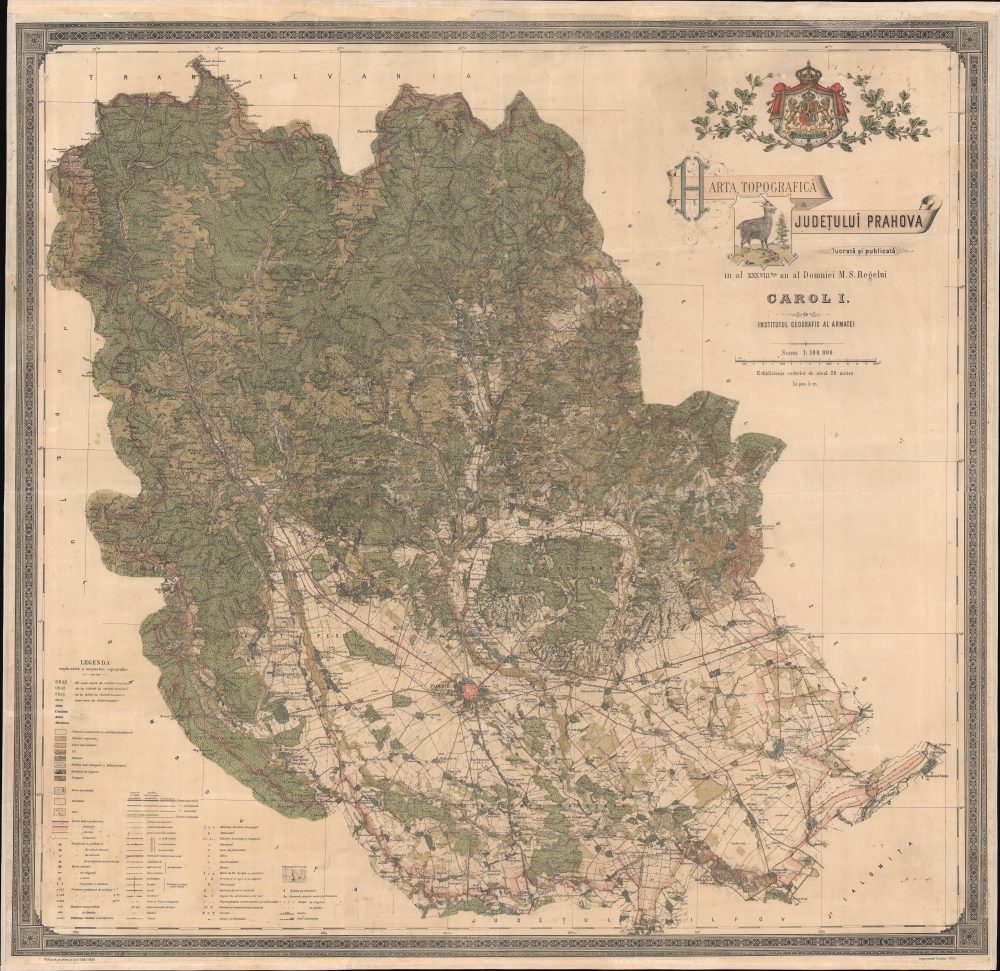
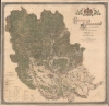
Harta Topografica Judetului Prahova.
1904 (dated) 40 x 41.5 in (101.6 x 105.41 cm) 1 : 100000
1904 (dated) 40 x 41.5 in (101.6 x 105.41 cm) 1 : 100000
Description
A rare 1904 chromolithograph wall map of Prahova and Transylvania, Romania issued by the Romanian Army Geographic Institute (Institutul Geografic al Armatei). Coverage embraces from just south of Brașov, Transylvania to the Ialomița River, just north of Bucharest. This includes the stunning Parcut Natural Bucegi (Bucegi Natural Park), with its rugged mountain scenery, unusual rock formations, and famous wild Black Goats - one of which is pictured in the title of this map. At a scale of 1:100000, the detail is stupendous, with individual properties, roads, and buildings noted. An extensive scale in the lower left details the elaborate coding through the map, where everything from factories, to mines, cemeteries, ruins, telegraph lines, and much more are identified.
Chromolithography
Chromolithography, sometimes called oleography, is a color lithographic technique developed in the mid-19th century. The process involved using multiple lithographic stones, one for each color, to yield a rich composite effect. Oftentimes, the process would start with a black basecoat upon which subsequent colors were layered. Some chromolithographs used 30 or more separate lithographic stones to achieve the desired product. Chromolithograph color could also be effectively blended for even more dramatic results. The process became extremely popular in the late 19th and early 20th centuries when it emerged as the dominant method of color printing. The vivid color chromolithography produced made it exceptionally effective for advertising and propaganda imagery.Publication History and Census
This map was printed by the Institutul Geografic al Armatei in 1904. It is based on a meticulous survey compiled between 1895 and 1899. This is the only known surviving example of this edition. We do note a 1938 edition in OCLC at the Staatsbibliothek zu Berlin. The Library of Congress (Phillips, 'Check List of Large Scale Maps Published by Foreign Governments') notes various maps with similar titles of other Romanian provinces, although not this one, suggesting it was part of a systematic national mapping effort.Cartographer
Institutul Geografic al Armatei (1895 - c. 1940) was the official geographical surveying, mapping, and publishing arm of the Romanian Army. It was organized in 1895 to complete a comprehensive series of national surveys, which is published between 1900 and 1905. More by this mapmaker...
Condition
Good. Professional restoration. Laid down on fresh linen.
References
OCLC 1195772134 (1938 issue).