
Kerns, Samuel M.

Samuel M. Kerns (18xx - 19xx) was one of three surveyors working for the U.S. Coast and Geodetic Survey who triangulated the position of Niihau relative to Kauai in 1903. He also completely surveyed Niihau by triangulation, the first such survey conducted and the only correct survey of the island up to that time. The previous survey of the island had been conducted thirty years prior. He also played a critical role in improving the street of Honolulu in the early 1900s.
First map of Niihau from a scientific survey.
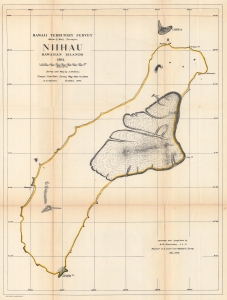
Hawaii Territorial Survey. Niihau Hawaiian Islands.
$350.00
Acquire
- Digital Map Information
- Suitable for large format printing
- File Size: 42.62 MB
- File Type: ZIP / TIFF
- ICC color profile embedded
- Delivered instantly via download link
The most accurate map of the island up to that time, this is the 1906 Kerns and Newton map of Niihau, Hawaiian Islands. The map is based on the 1903 Samuel M. Kerns survey, consigned to print in 1906 by Herbert E. Newton. It marks points, bays, and other coastal features. The lava fields around Puulua, Kaleo, and Paniau are illustrated. The elevation of Kawaihoa Point, on the southern tip of the island, is provided as well. (more details)