
Liesganig, Joseph Xaver
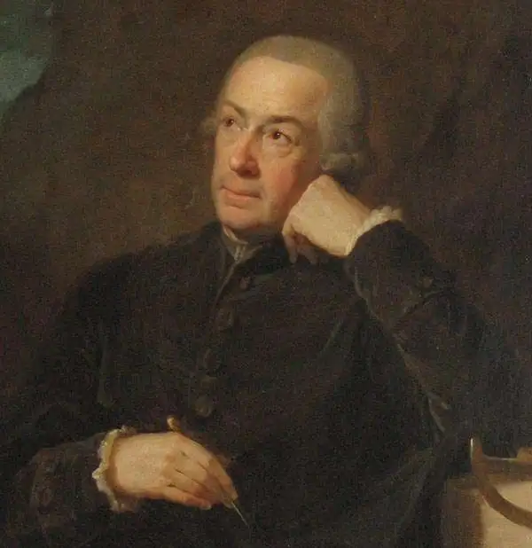
Joseph Xaver Liesganig (February 13, 1719 - March 4, 1799) was an Austrian Jesuit astronomer, mathematician, and surveyor. He was born in Graz, where his father was Hofmeister, giving him an entrée into the elite circles of the Habsburg empire. Liesganig studied at the Jesuit College in Vienna, graduating in 1734, and later became both a professor of mathematics at the University of Graz and an ordained Jesuit. The rest of his life was dedicated to the study of astronomy and related subjects. In 1752, he became a professor at the University of Vienna and an assistant at the important Jesuit observatory at his alma mater, the Jesuit College in Vienna. In 1756, he succeeded Maximilian Hell (1720 - 1792) as director of the observatory; Liesganig and Hell had many similarities, including being Jesuits, and the two became the most prominent astronomers of their age in the Habsburg realms. Among the important achievements during his tenure at the observatory in Vienna was the 1761 Transit of Venus, which led to several important discoveries, including the measurement of the distance between the Earth and the Sun. Much of Liesganig's research was dedicated to determining the exact size and shape of the Earth, a particular interest of Empress Maria Theresa. After years of geodetic measurements and astronomical observations, he published his findings in 1770 in Dimensio graduum meridiani Viennensis et Hungarici. After the First Partition of Poland in 1772, Liesganig led a team to map the new lands annexed by the Habsburgs (the 'Kingdom of Galicia and Lodomeria'), after which he became head of a new astronomical observatory in Lviv, which he headed until his death, even following the suppression of the Jesuits. He is credited with introducing the science of triangulation to Habsburg Austria.
Most Important Map of of the Polish-Ukraine Border Kingdom.
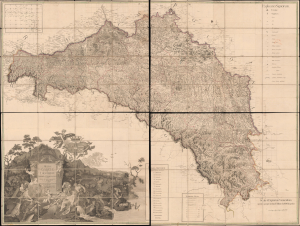
Regna Galicia, et Lodomeriae Josephi II et M. Theresiae Augg. iussu methodo astronomico-trigonometrica, nec non Bukovina geometrice dimensa...
$6,500.00
Acquire
- Digital Map Information
- Suitable for large format printing
- Full resolution TIFF file
- ICC color profile embedded
- Delivered instantly via download link
This is the 1790 first edition of Joseph Liesganig's seminal and massive map of Galicia, a territory roughly conforming to the modern border between Poland and Ukraine. The region, which had been granted to the Habsburgs in the First Partition of Poland, was virtually unmapped using modern methods before Liesganig and his team spent months preparing the present work, making it one of the most important maps of Eastern Europe of the era. (more details)