
Litografía del Estado Mayor General

Litografía del Estado Mayor General (c. 1895 - 1935) served as the official lithographic press and cartographic publishing office for the General Staff of the Colombian Army. Established in Bogotá as the Imprenta del Comando General (sometimes also as Imprenta del Estado Mayor General), it functioned as the state body for converting field surveys, military reconnaissance, public works blueprints, and territorial studies into standardized official maps. The press published maps and documents ranging from regional infrastructure plans to strategic border maps created during geopolitical crises, including the 1932 - 1933 Colombia - Peru War over the Amazonian Trapezium. It also served as an institutional bridge between early 19th-century private printmaking and the establishment of centralized state agencies like the Instituto Geográfico Militar y Catastral in 1935.
A Planned Interoceanic Route in Colombia's Remote Northwest.
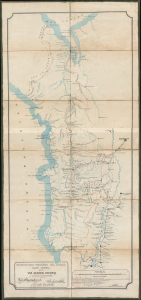
Intendencia Nacional del Choco. Plano general de la via Quibdo Negria y de algunas de sus conexiones.
$950.00
Acquire
- Digital Map Information
- Suitable for large format printing
- Full resolution TIFF file
- ICC color profile embedded
- Delivered instantly via download link
This is a c. 1924 map of the Chocó intendencia (now a departamento) in northwest Colombia, prepared by the territory's Anglo-Colombian engineer, Roberto J. White. The map presents an ambitious scheme White laid out to connect north- and south-running rivers in Chocó that empty into the Atlantic and Pacific Oceans, respectively, creating an interoceanic route capable of handling heavy cargo. This was a particularly important goal at the time as Chocó became one of the main international sources of platinum in the early 20th century and experienced a mining boom. (more details)