
Lodge, John

John Lodge (1735-1796) was a British engraver, map seller, draughtsman and stationer active in London from roughly 1755 to the late 18th century. Lodge, born in London, was apprenticed to Thomas Jefferys, one of the most prominent and prolific map publishers and engravers of his day. He produced several maps for The Gentleman's Magazine and The Political Magazine and other publications. He also engraved book-illustrations, portraits and botanical plates and taught etching and engraving. Around the 1780's, he is believed to have lived to Dublin, where he did a significant amount of engraving work for Dublin booksellers. Lodge was survived by his wife Ann, to whom he left his entire estate, and his son John Lodge, who was also an engraver.
Giving hope to the revolutionary cause.
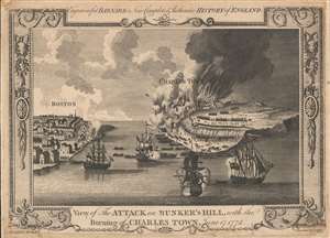
View of the Attack on Bunker's Hill, with the Burning of Charles Town, June 17, 1775.
$800.00
Acquire
- Digital Map Information
- Suitable for large format printing
- DPI: 600
- File Size: 7.65 MB
- File Type: ZIP / TIFF
- ICC color profile embedded
- Delivered instantly via download link
One of the earliest obtainable views of the 1775 American Revolutionary War (1775 - 1783) Battle of Bunker Hill. Published in 1783, this view illustrates the June 17, 1775, Battle of Bunker Hill, near Boston, one of the first and most significant battles of the war. (more details)
Giving hope to the revolutionary cause.
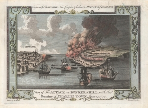
View of the Attack on Bunker's Hill, with the Burning of Charles Town, June 17, 1775.
$1,200.00
Acquire
- Digital Map Information
- Suitable for large format printing
- DPI: 600
- File Size: 16.6 MB
- File Type: ZIP / TIFF
- ICC color profile embedded
- Delivered instantly via download link
One of the earliest obtainable views of the 1775 American Revolutionary War (1775 - 1783) Battle of Bunker Hill. Published in 1783, this view illustrates the June 17, 1775, Battle of Bunker Hill, near Boston, one of the first and most significant battles of the war. (more details)