
Macpherson, Alexander

Alexander Macpherson (fl. c. 1806 - 1847) was a London-based engraver of maps in the early 19th century.
One of the earliest accurate European maps of the Tigrayan highlands.
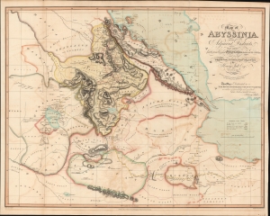
Map of Abyssinia and the adjacent districts laid down partly from original Observations taken in the Country and partly compiled from information collected there by Henry Salt Esq.
$950.00
Acquire
- Digital Map Information
- Suitable for large format printing
- DPI: 600
- File Size: 886.25 MB
- File Type: ZIP / TIFF
- ICC color profile embedded
- Delivered instantly via download link
A striking and important 1814 map of northern Abyssinia (Ethiopia) and surrounding territories by the English artist, diplomat, and Egyptologist Henry Salt. One of the earliest highly accurate European maps of the Tigrayan highlands, it appeared in Salt's A Voyage to Abyssinia and travels into the interior of that country. (more details)