
Mitchell, John

John Mitchell (April 13, 1711 – February 29, 1768) was and British-American mapmaker of great significance. He is known for one and only one map, the 'Mitchell Map', considered the most important map in 18th century American history. Mitchell was born in Lancaster County, Virginia, the son of a prosperous planter and merchant. Like many of his social peers, he was educated in Europe, at Scotland at Edinburgh University, where he studied medicine. Mitchell practiced medicine in Virginia for a short time prior to the French and Indian War. He was elected to the original American Philosophical Society in 1744. In 1745 Mitchell argued that a series of epidemics occurring in Virginia were due to unsanitary troop ships from Britain - at the time a revolutionary idea. He relocated to London in 1746 - presumably for the agreeable climate. Mitchell never practiced medicine in London, but was known to be an avid botanist, and was considered an exotic plant expert in London society circles. He was elected as a fellow of the Royal Society in November 1748, his candidature citation describing him as
A Gentleman of great merit and Learning, who Some time Since communicated to the Royal Society a very curious dissertation concerning the Colour of the skin in Negroes, and who from his long residence in Virginea, and from his great application to the Study of Natural history, especially Botany, is very well acquainted with the vegetable productions of North America, being desirous of being admitted a fellow of the Royal Society, is recommended by us from our personal knowledge of him as highly deserving the Honour he desires, as we believe he will be (if chosen) a usefull and valuable member of our Body.As an educated American adopted into British high society, Mitchell became the de facto expert on all matters North American. In 1749, during a time of ever-increasing political tensions between British and French interests in America, Lord Halifax contracted Mitchell to produce a large and detailed map of British and French dominions in America. While embracing the most advanced geographical data, Mitchell also advocated pro-British interpretation of political boundaries. The resulting map was thus geographically unimpeachable and reframed the cartographic perspective from French to British terms. The map proved significant and was used in most subsequent treaties. Michell issued 3 editions in his lifetime. He died in London in 1768.
The British Colonies on the cusp of Revolution.
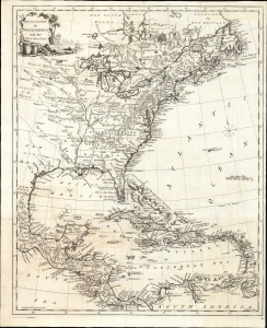
British Empire in North America with the West India Isles.
$2,400.00
Acquire
- Digital Map Information
- Suitable for large format printing
- File Size: 15.2 MB
- File Type: ZIP / TIFF
- ICC color profile embedded
- Delivered instantly via download link
This is Thomas Kitchin's 1770 map of the British Empire in North America, presenting the state-of-the-art mapping of the Colonies on the cusp of the American Revolutionary War (1775 - 1783). It combines the foundational cartography of John Mitchell (north) with the still-authoritative work of Jean-Baptiste Bourguignon d'Anville (south). (more details)
Most important map in 18th century American history.
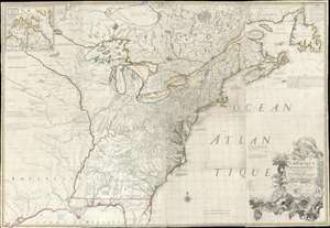
Amerique Septentrionale avec Les Routes, Distances et miles, Villages et Etablissements François et Anglois Par le Docteur Mitchel.
$12,000.00
Acquire
- Digital Map Information
- Suitable for large format printing
- Full resolution TIFF file
- ICC color profile embedded
- Delivered instantly via download link
This is the important 1777 Georges Le Rouge French edition of the seminal John Mitchell map of the eastern part of North America. The Mitchell map is considered the single most important map in 18th-century American history. It was used as a primary reference for nearly every treaty and boundary dispute in colonial North America from the French and Indian War (1754 - 1763) through the late 19th century. The map is all the more astounding because this is Mitchell's one and only map - a truly remarkable feat of virtuosity. (more details)
Crossroads of the North American Fur Trade.
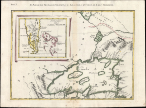
Folg. I. Il Paese deʼ Selvaggi Outauacesi, e Kilistinesi Intorno al Lago Superiore.
$750.00
Acquire
- Digital Map Information
- Suitable for large format printing
- File Size: 12.26 MB
- File Type: ZIP / TIFF
- ICC color profile embedded
- Delivered instantly via download link
This is Antonio Zatta's 1778 map of Lake Superior and environs, issued at the height of the American Revolutionary War (1775 - 1783). Although separately published, the sheet forms Plate I of Zatta's 12-sheet Italian edition of John Mitchell's seminal map of eastern North America. Zatta, however, includes additions not present on Mitchell's map, relating to the names of rivers, native peoples, and settlements. (more details)
Border dispute in the Great North Woods.
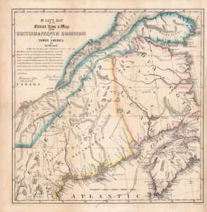
Mr. Jay's map : extract from a map of the British and French dominions in North America.
$900.00
Acquire
- Digital Map Information
- Suitable for large format printing
- Full resolution TIFF file
- ICC color profile embedded
- Delivered instantly via download link
An 1843 map of the U.S.-Canada border region, including portions the states and provinces of Maine, New Hampshire, Quebec, New Brunswick, and Nova Scotia, as it appeared one century prior. This map is a reissue of a portion of a 1755 map by John Mitchell which played an important role in settling the boundary between the American Republic and British North America (Canada) in the late 19th century. It was republished in the aftermath of the 'Aroostook War,' an Anglo-American diplomatic dispute between 1838 and 1842 over the same boundary, appearing in Albert Gallatin's A Memoir on the North-Eastern Boundary, in Connection with Mr. Jay's Map. (more details)