
Neele, Josiah

Josiah Neele (March 30, 1804 - March 22, 1876) was a British map engraver, printer, and publisher active in London during the middle part of the 19th century. Neele was the son of Samuel John Neele (1758 - 1824), also a prominent map engraver. He apprenticed under his father along with Ebenezer Stalker (1780 - 1847) with whom he briefly partnered until 1825. At that time, he went into business with his uncle, George Neele, and his brother, James Neele. George retired in 1826, ending that partnership, after which the brothers published until 1829 under the imprint of 'James and Josiah Neele'. Josiah subsequently continued the business under his own name, operating from their former offices at 352 Strand, until 1836, when he declared bankruptcy. In 1845 he married Eliza Atwood of Haverfordwest and in the wedding documents he is described as a stationer. He retired to Wiltshire in 1871 and died five years later in 1876.
Grandest Cartographic Representation of Regency London.
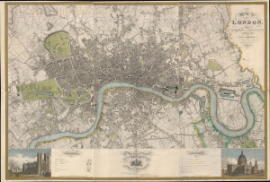
Map of London, from An Actual Survey made in the Years 1824, 1824 and 1826 by C. an J. Greenwood.
$15,000.00
Acquire
- Digital Map Information
- Suitable for large format printing
- Full resolution TIFF file
- ICC color profile embedded
- Delivered instantly via download link
This is the rare first edition of Christopher and John Greenwood's large-scale 1827 map of London, produced at the height of the Regency period, during which the city was being crafted into a neoclassical metropolis, driven by the Prince Regent (George IV) himself but realized by his favored architect, John Nash. Greenwood's map, in its grand presentation and monumental scope, is the essential cartographic expression of the Regency, and it is considered the largest and finest plan of London to appear in the 19th century. (more details)
Waning Days of Antigua's Plantation Economy.
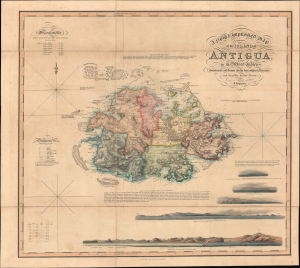
A New and Improved Map of the Island of Antigua, in the West Indies.
$3,000.00
Acquire
- Digital Map Information
- Suitable for large format printing
- Full resolution TIFF file
- ICC color profile embedded
- Delivered instantly via download link
This is J. Johnson's rare 1829 folding map of Antigua, published by Smtih, Elder, and Co. It holds both cartographic and historical significance, being the only major map of Antigua produced between 1793 and 1852, and, having been issued on the eve of the abolition of slavery, capturing the island in the late stages of the plantation slavery economy. (more details)
A beautiful map of England and Wales framed by vignettes of historic landmarks and figures.
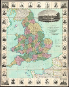
This New Map of England and Wales, with the Adjacent Countries, Compile by Surveyors Employed in the Ordnance Department, is Respectfully Dedicated to the King.
$800.00
Acquire
- Digital Map Information
- Suitable for large format printing
- DPI: 600
- File Size: 155.87 MB
- File Type: ZIP / TIFF
- ICC color profile embedded
- Delivered instantly via download link
This is a stunning c. 1830 Robert Seaton large-format folding case map of England and Wales. The map depicts the region from Ireland to the North Sea and from the Firth of Forth in Scotland to Paris, France. Beautifully executed and wonderfully adorned, the counties of England and Wales are all shaded different colors to allow for easy differentiation. A large, finely engraved view of Windsor Castle is situated at the upper right. The whole is surrounded by a pictorial border populated by portraits of famous British figures, including Shakespeare, Nelson, Raleigh, Byron, Milton, and Wellington. Views of Canterbury Cathedral, York Minster, St. Paul's Cathedral, and Westminster Abbey occupy the corners. (more details)