1835 Seaton Map of the Holy Land: Israel and Palestine
HolyLand-seaton-1835$950.00


Title
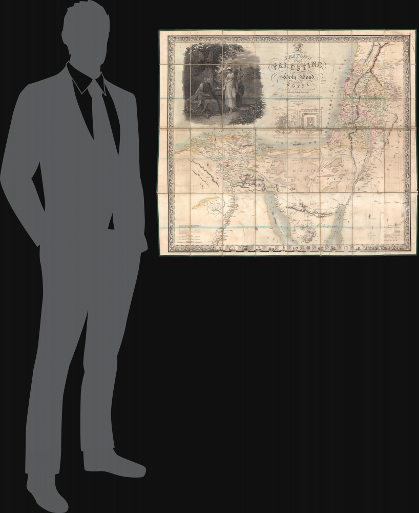
Seaton's Map of Palestine, or the Holy Land, with part of Egypt.
1835 (undated) 33.5 x 38.5 in (85.09 x 97.79 cm) 1 : 800000
1835 (undated) 33.5 x 38.5 in (85.09 x 97.79 cm) 1 : 800000
Description
This is a first edition example of Robert Seaton's 1835 map of Palestine or the Holy Land. It is one of the most decorative maps of the Israel / Palestine / Syria region to appear in the 19th century.
A Closer Look
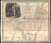
Meant to illustrate events from scripture, the map covers northern Egypt and the Nile Delta, most of the Sinai Peninsula, the northern extremes of the Red Sea, the Gulf of Aqaba (or Eilat), all of modern-day Israel and Palestine, and parts of Lebanon, Jordan, and Syria. Smaller inset plans detail the Temple and Jerusalem. The map is dominated by a large and impressive vignette engraving illustrating Jesus in a scene from the Gospel of John wherein he meets a Samaritan woman at a well in Sychar.Publication History and Census
This map was engraved by Josiah Neele and published by Robert Seaton in 1835. The title suggests that the map was intended to accompany a companion volume, also by Seaton, but that was not published until 1836. The present example is the first edition. A second edition, with a revised title, A New Map of Palestine or the Holy Land with Part of Egypt was issued around 1853 to reflect new survey work in Egypt. Most examples are dissected and mounted on linen although wall map format issues are also known. The map is scarce to the market, but well represented institutionally.CartographerS
Robert Seaton (fl. c. 1835 - 1836) was a British mapmaker who held the post of Hydrographer to the King. Despite the impressive title, we are only able to identify two maps by Seaton, Seaton's Map of Palestine and the Holy Land, and a New Map of England and Wales, both engraved by Josiah Neele (1804 - 1876) and published in 1835. More by this mapmaker...
Josiah Neele (March 30, 1804 - March 22, 1876) was a British map engraver, printer, and publisher active in London during the middle part of the 19th century. Neele was the son of Samuel John Neele (1758 - 1824), also a prominent map engraver. He apprenticed under his father along with Ebenezer Stalker (1780 - 1847) with whom he briefly partnered until 1825. At that time, he went into business with his uncle, George Neele, and his brother, James Neele. George retired in 1826, ending that partnership, after which the brothers published until 1929 under the imprint of 'James and Josiah Neele'. Josiah subsequently continued the business under his own name, operating from their former offices at 352 Strand, until 1836, when he declared bankruptcy. In 1845 he married Eliza Atwood of Haverfordwest and in the wedding documents he is described as a stationer. He retired to Wiltshire in 1871 and died five years later in 1876. Learn More...
Condition
Good. Dissected and mounted on linen in thirty-two (32) panels. Minor discoloration.
References
OCLC 974964430. Laor, E., Maps of the Holy Land: Cartobibliography of Printed Maps, 1475 - 1900, 712.