
New South Wales Department of Lands

New South Wales Department of Lands (c. 1880 – 2008) was the land management bureaucracy of the New South Wales government. It played a critical role in the development of the colony (or state, after 1901), allocating land to immigrants and managing the natural resources of the area. Even today, more than half of the land in New South Wales is 'crown land,' either protected land or lands with public use, such as airports or military bases. In recent years, moves have been made to restructure the bureaucracy and sell more crown lands for development purposes. Over the course of its existence, the Department published thousands of maps.
Syndey near the End of the Colonial Era.
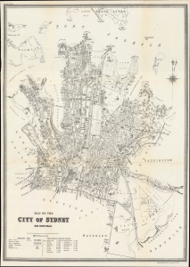
Map of the City of Sydney New South Wales.
$750.00
Acquire
- Digital Map Information
- Suitable for large format printing
- File Size: 28.28 MB
- File Type: ZIP / TIFF
- ICC color profile embedded
- Delivered instantly via download link
This is a 1895 city plan of Sydney, New South Wales, Australia, prepared by the colony's Department of Lands. It presents the city during a period of rapid growth, when it was adding suburbs and developing world-class parks and infrastructure. (more details)
Modernity and national federation.
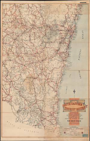
Map of the South Eastern Tourist District.
$600.00
Acquire
- Digital Map Information
- Suitable for large format printing
- Full resolution TIFF file
- ICC color profile embedded
- Delivered instantly via download link
This is a rare 1924 tourist map of New South Wales made by the state's Department of Lands. It focuses on road and rail routes between cities and to popular tourist destinations listed in the title: 'Burrinjuck, Federal Territory, Jenolan, Yarrangobilly and Wombeyan Caves, Mt. Kosciusko and principal fishing streams.' (more details)