1924 Tourist Map of New South Wales, Australia
NewSouthWales-landdept-1924$600.00


Title
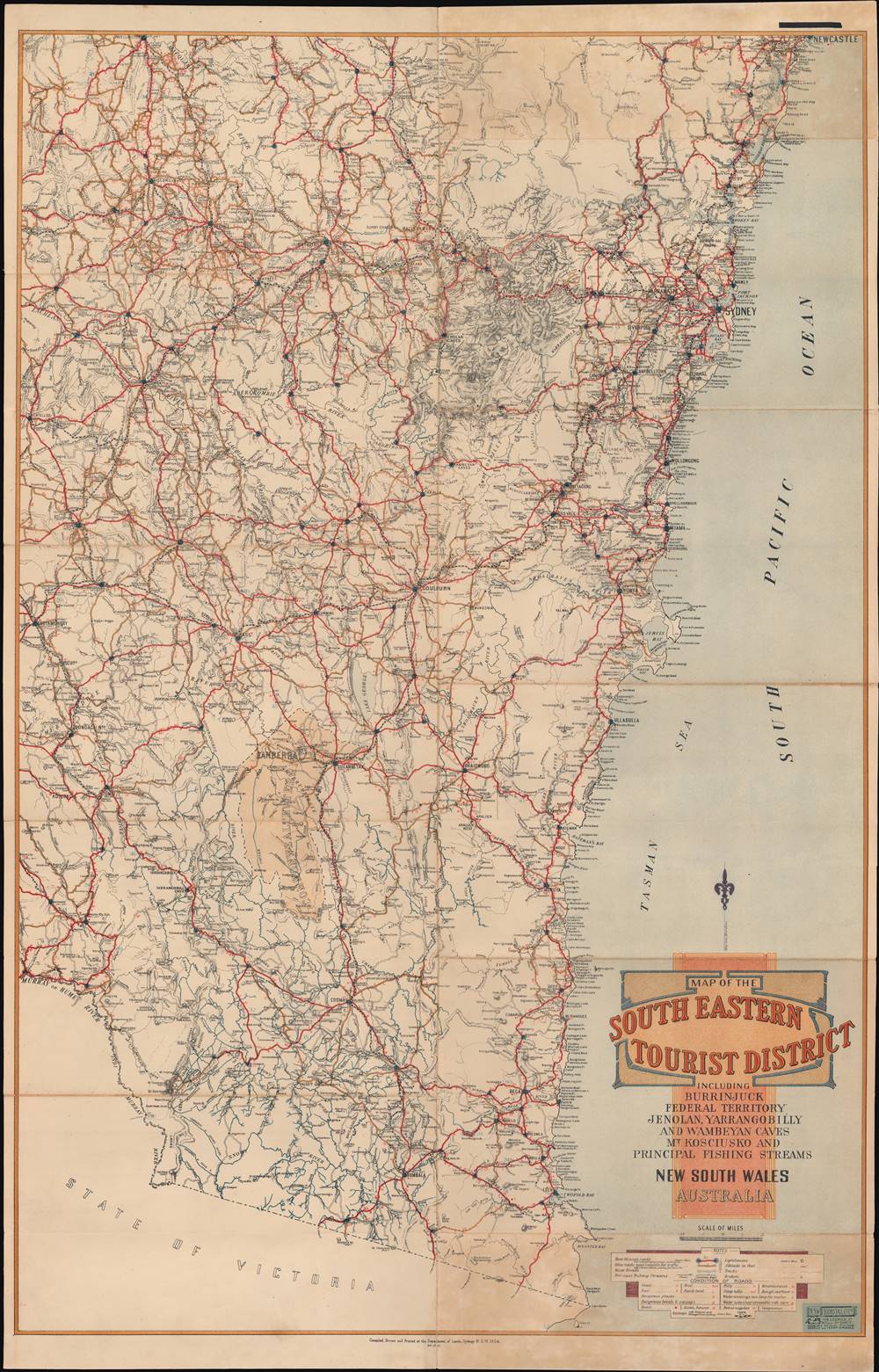
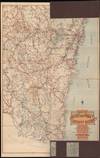
Map of the South Eastern Tourist District.
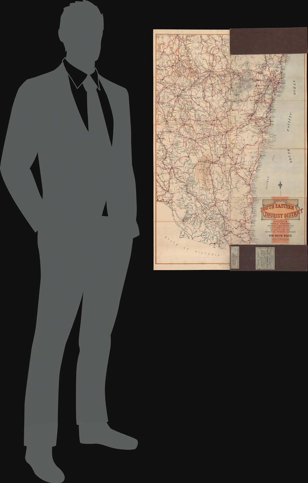
1924 (dated) 35.5 x 22.75 in (90.17 x 57.785 cm) 1 : 633600
1924 (dated) 35.5 x 22.75 in (90.17 x 57.785 cm) 1 : 633600
Description
This is a rare 1924 tourist map of New South Wales made by the state's Department of Lands. It focuses on road and rail routes between cities and to popular tourist destinations listed in the title: 'Burrinjuck, Federal Territory, Jenolan, Yarrangobilly and Wombeyan Caves, Mt. Kosciusko and principal fishing streams.'
Sydney and other cities in the colony/state had grown considerably in the late 19th century, spurred on by immigration and the development of new industries, including a gold rush in the 1850s - 1870s. The New South Wales Department of Lands played a critical role in settling the rapid influx of migrants and was the most important section of the nascent bureaucracy at that time. True to its importance, the Department occupied a grandiose Victorian Renaissance Revival building in Sydney that still stands.
The next task was to settle on a suitable choice in the countryside of New South Wales. Initially, in 1904, Dalgety (at bottom-center) had been chosen as the site, but this was opposed in New South Wales as Dalgety was nearly as close to Melbourne as it was to Sydney, and by 1908 the area later called Canberra had edged out Dalgety and became the choice as national capital.
In the end, the process of selecting, surveying, and planning for the building of a new city took years, and the Parliament House was not completed until 1927. Even afterwards, the city remained small and underdeveloped until after World War II. The relative isolation of the capital can be seen here, as most roads and railways shot right past it, save for the lines meeting at Queanbeyan on the border of the federal territory (the existence of this rail junction was also an important factor in choosing Canberra over Dalgety).
A Closer Look
The map contains detailed information on the type and state of motor roads and the distances between major destinations, as well as similar information for railways. It provides comprehensive reconnaissance for the traveler, including the location of hotels and guest houses, petrol stations, and telephones, reflecting both the increasing use of automobiles and leisure travel by those who could afford it.Historical Context
This map was made during a period of transition in New South Wales, soon after the colonies had federated in 1901 and become states. While New South Wales was chosen as the site of a new national capital (after much debate, described below), it maintained a strong regional identity and policies that were jealously guarded against other states, particularly Victoria, an ancillary to the long-running rivalry between Sydney and Melbourne.Sydney and other cities in the colony/state had grown considerably in the late 19th century, spurred on by immigration and the development of new industries, including a gold rush in the 1850s - 1870s. The New South Wales Department of Lands played a critical role in settling the rapid influx of migrants and was the most important section of the nascent bureaucracy at that time. True to its importance, the Department occupied a grandiose Victorian Renaissance Revival building in Sydney that still stands.
Building a National Capital
One of the main issues to resolve in the course of federation was the location of a national capital, which took nearly a decade to negotiate and even longer to build. New South Wales was hesitant about joining the proposed federation for several reasons, but a federation without the state included would hardly be complete. As Sydney and Melbourne were the logical choices for a capital but also rivalrous with each other, a compromise was reached to have New South Wales join the federation and be the home of the capital, so long as the capital was not Sydney.The next task was to settle on a suitable choice in the countryside of New South Wales. Initially, in 1904, Dalgety (at bottom-center) had been chosen as the site, but this was opposed in New South Wales as Dalgety was nearly as close to Melbourne as it was to Sydney, and by 1908 the area later called Canberra had edged out Dalgety and became the choice as national capital.
In the end, the process of selecting, surveying, and planning for the building of a new city took years, and the Parliament House was not completed until 1927. Even afterwards, the city remained small and underdeveloped until after World War II. The relative isolation of the capital can be seen here, as most roads and railways shot right past it, save for the lines meeting at Queanbeyan on the border of the federal territory (the existence of this rail junction was also an important factor in choosing Canberra over Dalgety).
Publication History and Census
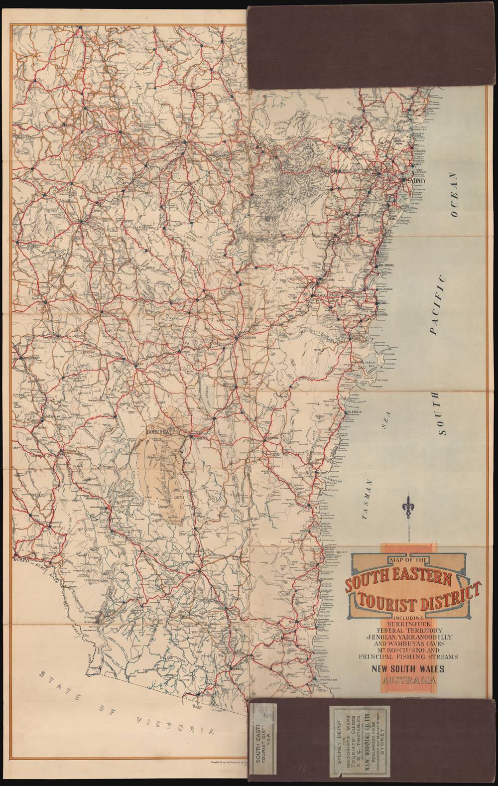
This map was compiled, drawn, and printed by the New South Wales Department of Lands in 1924, and sold by the NSW Bookstall Co. Ltd. (specifically, the Sydney Depot for Motorists' Maps, Tourist Guides'). This edition is only known to be held by the State Library of Victoria and has no known history on the market. There are at least nine editions of this map, as well as accompanying maps published in multiple editions by the Department of Lands: 'Map of the North Eastern Tourist District,' 'Map of the Central Northern Tourist District,' and 'Map of the Central Southern Tourist District.' All of these are quite scarce, but some are held by the National Library of Australia and the University of Melbourne.CartographerS
New South Wales Department of Lands (c. 1880 – 2008) was the land management bureaucracy of the New South Wales government. It played a critical role in the development of the colony (or state, after 1901), allocating land to immigrants and managing the natural resources of the area. Even today, more than half of the land in New South Wales is 'crown land,' either protected land or lands with public use, such as airports or military bases. In recent years, moves have been made to restructure the bureaucracy and sell more crown lands for development purposes. Over the course of its existence, the Department published thousands of maps. More by this mapmaker...
The New South Wales Bookstall Company (1879 – 1957), often stylized as NSW Bookstall Company, started as a string of bookstalls at railway stations, founded by Henry Lloyd. After some forays into publishing under Llyod, the company began publishing on a mass scale under a new owner, A.C. Rowlandson, at the end of the 19th century. True to the company's origins, their publications were mainly intended for a mass market, richly illustrated and portable for ease of use by travelers and commuters. Rowlandson was credited with importing a wide range of foreign books and newspapers while also promoting Australian authors, to the point that he and his company played an important part in the formation of a national identity. The company declined after Rowlandson's death and the company had stopped publishing new titles by the late 1940s; its distribution and bookstall operations ended in 1959. Learn More...
Condition
Good. Original fold lines visible. Some toning due to the fold metric.
References
OCLC 1004374875.