
Nolin, Jean-Baptiste

Jean-Baptiste Nolin (1657 - 1725) was a French cartographer and publisher active in Paris during the late 17th and early 18th centuries. Nolin was a man of exceptional business acumen and while many cartographers struggled financially, he prospered. Many attribute this to the fact that Nolin produced very little original work, relying primarily on business relationships with the legendary Italian cartography Vincenzo Coronelli, Jean-Dominique Cassini, and the French geographer Jean Nicolas du Trallage, Sieur de Tillemont (1620 – 1698). His work is known for exceptional aesthetic élan, combining Italianesque baroque and rococo ethics with most current cartographic data. It might also be said that Nolin was a bit of a con-artist in his self-promotion, often inaccurately using such titles as 'Engraver to the King' and 'Geographer to the Duke of Orleans', neither of which appointments he actually held. In 1705, he was successfully sued by Guillaume De L’Isle for copyright infringement, a case which cost him significant scientific credibility. Nonetheless, Nolin remained commercially popular and prosperous. Nolin's son, also Jean Baptiste Nolin (1686 - 1762) inherited his father’s map plates and republished many of his maps, as well as issuing his own unique maps, well into the 18th century. Both Nolins maintained offices on Rue St. Jacques, Paris.
'... most momentous map of the American south-west published ...' - Burden
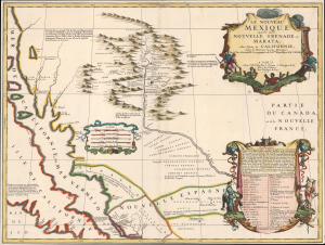
Le Nouveau Mexique appelé aussi Nouvelle Grenade et Marata Avec Partie de Californie, Selon les Memoires les plus Nouveaux.
$14,500.00
Acquire
- Digital Map Information
- Suitable for large format printing
- File Size: 17.16 MB
- File Type: ZIP / TIFF
- ICC color profile embedded
- Delivered instantly via download link
A seminally important map, this is the 1687-88 Coronelli-Nolin separately-published map of the North American Southwest, in its first edition. This map is a cornerstone for any collection dedicated to the southwest: it is the first published map to introduce the cartography of Don Diego Peñalosa with regard to the Rio Grande valley as far north as Santa Fe. Peñalosa's cartography not only has a swashbucklingly enigmatic history, but it is also foundational for most subsequent maps of the region for the next century. This is also one of the earliest maps, following the 1660 Nicolosi map, to correctly map the Rio Grande emptying into the Gulf of Mexico as opposed to the Sea of California. (more details)
Early Jesuit Map of China.
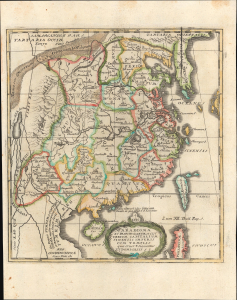
Paradigma XV Provinciarum et CLV Urbium Capitalium Sinensis Imperij Cum Templis quae Cruce X Signatur Et Domiciliis S.I.
$550.00
Acquire
- Digital Map Information
- Suitable for large format printing
- File Size: 4.59 MB
- File Type: ZIP / TIFF
- ICC color profile embedded
- Delivered instantly via download link
This is Joseph Stöcklein's c. 1729 map of China, prepared for his Der Neue Welt-bott. It was an important piece of early cultural exchange between China and Europe, which helped spur the Enlightenment. (more details)
Holy grail of Siam map collecting.
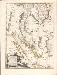
Royaume De Siam, avec Les Royaumes qui luy sont-Tributaries, et les Isles de Sumatra, Andemaon, etc.
$10,000.00
Acquire
- Digital Map Information
- Suitable for large format printing
- Full resolution TIFF file
- ICC color profile embedded
- Delivered instantly via download link
This is the important and influential Coronelli-Nolin map of Southeast Asia, considered one of the Holy Grails of Siam-related map collecting. Here in its 1742 edition, the map was first issued in 1687, following the 1685 first French embassy to Siam, led by Alexandre, Chevalier de Chaumont (1640 - 1710). Most Europeans were expelled from Siam a year later in 1688, making this the definitive model of all subsequent maps of Siam, and Southeast Asia in general until the 1821 John Crawfurd Embassy. (more details)
Dramatic 18th century wall map!
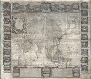
L'Asie Dressée Sur Les Nouvelles Observations Faites En Toutes Les Parties De La Terre Et Rectifiées.
$5,000.00
Acquire
This is an impressive and rare 1749 decorative wall map of Asia by Jean-Baptiste Nolin. It offers both decorative appeal and significant cartographic interest: Witsen's Peninsula, Lake Chiamay, Gamaland, ethnographic commentary, and more. (more details)