
Palha, J. M. F.

J. M. F. Palha (fl. c. 1863 – 1875) was a Portuguese cartographer and engraver who produced maps of Lisbon, Portugal, and Macau.
Groundbreaking Map of the African Interior.
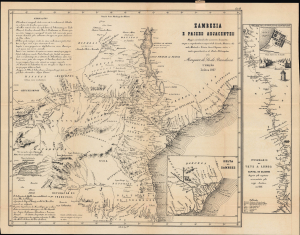
Zambezia e paizes adjacentes. Mappa coordenado sobre numerosos documentos, em que se comprehendem as viagens do Dr. Lacerda; Monteiro e Gamitto; Montanha e Teixeira; Green, Chapman e outros; e muito especialmente as do illustre Dr. Livingstone.
$1,200.00
Acquire
- Digital Map Information
- Suitable for large format printing
- Full resolution TIFF file
- ICC color profile embedded
- Delivered instantly via download link
A cartographic landmark in the European exploration of southeastern Africa, this is the rare 1867 second edition of the Marquess de Sá da Bandeira's groundbreaking map of the Zambezi River and its vast hinterland. The most comprehensive European mapping of the region then published, it synthesizes Portuguese colonial records, British geographical intelligence, indigenous place names, commercial routes, and accounts of exploration to chart the territory from Lake Nyasa and the Zambezi Valley south to the Limpopo River and inland toward the Kazembe and Lunda kingdoms. More than a record of geographical discovery, the map is also an instrument of imperial ambition, issued as Portugal sought to transform its tenuous coastal claims in Mozambique into meaningful control over the African interior amid the accelerating expansion of British influence in southern Africa. (more details)