
Peters, Norris

Norris Peters (c. 1834 – July 15, 1889) was a Washington D.C. based photo-lithographer active in the late 18th and early 19th century whom Scientific American called 'one of Washington's most eccentric and mysterious figures.' Peters was born and educated in Pennsylvania. He relocated as a young man to Washington D.C. where he took work as an examiner for the United States Patent Office. During his work with the patent office he became fascinated with the emergent process of photolithography. In 1869 Peters secured substantial venture capital of about 100,000 USD from an unknown investor and founded The Norris Peters Company at 458 Pennsylvania Avenue. Their printing offices have been described as 'unequaled in this or any other country.' From these offices Peters pioneered the development of American photo-lithography. For nearly a generation he held a near monopoly on government photo-lithographic printing. Among their more notable contracts included numerous maps for congressional reports, maps of the U.S. Coast Survey, maps of the U.S. Geological Survey, Mexican currency for the State of Chihuahua, and the Official Gazette of the Patent Office. Peters also maintained an interesting social life and was a confidant to many of the most powerful figures in Congress. He was also a bon vivant known for being an excellent cook and hosting lavish dinners, the invitations to which were 'never declined'. Despite being socially active he never married and died a confirmed bachelor. Following Peters' death in 1889 his business was taken over by Henry Van Arsdale Parsell who administered it until his own death in 1901. The company then merged with Webb & Borcorselski, another D.C. lithography firm, and was renamed Webb & Borcorselski-Norris Peters. They continued to publish under this name well into the mid 20th century.
Southernmost Part of Alaska.
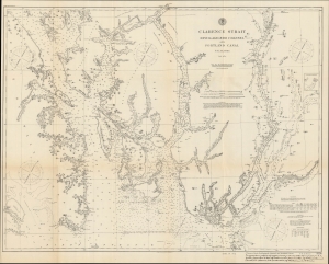
Clarence Strait Revillagigedo Channel and Portland Canal S.E. Alaska.
$300.00
Acquire
- Digital Map Information
- Suitable for large format printing
- File Size: 24.42 MB
- File Type: ZIP / TIFF
- ICC color profile embedded
- Delivered instantly via download link
A highly detailed 1895 U.S. Coast Survey nautical map of the southeastern corner of Alaska, including the Gravina Islands of the Alexander Archipelago, the Portland Channel, and Ketchikan. This region was one of the most hotly debated portions of the Alaska-Canada border during an extended dispute at the end of the 19th century, set off by the discovery of gold in Alaska and the Yukon. (more details)
Alaska near the height of the Klondike Gold Rush.
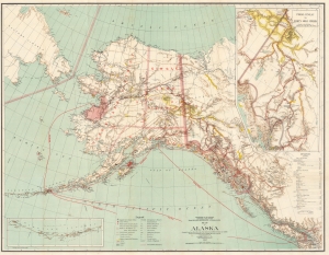
Map of Alaska.
$450.00
Acquire
- Digital Map Information
- Suitable for large format printing
- File Size: 51.18 MB
- File Type: ZIP / TIFF
- ICC color profile embedded
- Delivered instantly via download link
This 1898 Matthew Hendges map of Alaska captures the region near the height of the Klondike Gold Rush. Frontier gold rushes are an integral part of American history of the 19th century and, even today, capture the imagination of those hoping to strike it rich. (more details)
Work of the USS Albatross in the Atlantic and Pacific Oceans between 1883 and 1900.
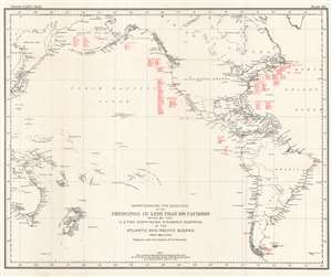
Chart Showing the Locations of the Dredgings in Less Than 100 Fathoms Made by the U.S. Fish Commission Steamship Albatross in the Atlantic and Pacific Oceans from 1883 to 1900.
$250.00
Acquire
- Digital Map Information
- Suitable for large format printing
- File Size: 20.76 MB
- File Type: ZIP / TIFF
- ICC color profile embedded
- Delivered instantly via download link
This is a 1900 C. H. Townsend and U.S. Fish Commission map of Atlantic and Pacific Ocean floor samplings less than 100 fathoms. Red numbers identify these dredging locations and can be correlated with detailed data in USS Albatross archives. Stretching from Japan to the Azores and from the Bering Sea to Cape Horn, dredgings marked were collected by the Albatross between 1883 and 1900. Unlike other maps in this series, dredging locations are marked in red but in many places dredging data is grouped geographically. Each grouping is labeled, including 'Bering Sea', 'Off Cal.', 'Off Washington' 'Off Col[ombia], and G. of Mex. And Vicinity. (more details)
The work of the USS Albatross throughout the Atlantic Ocean and eastern Caribbean Sea on her way to the Pacific.
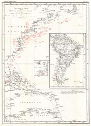
Chart Showing the Positions of the Dredgings Deeper than 100 Fathoms Made by the U.S. Fish Commission Steamship Albatross in the North Atlantic Ocean, Caribbean Sea, and around South America from 1883 to 1888.
$250.00
Acquire
- Digital Map Information
- Suitable for large format printing
- File Size: 15.67 MB
- File Type: ZIP / TIFF
- ICC color profile embedded
- Delivered instantly via download link
This is a 1900 C. H. Townsend and U.S. Fish Commission map of Atlantic Ocean Caribbean Sea floor samplings deeper than 100 fathoms. Red numbers identify these dredging locations and can be correlated with detailed data in USS Albatross archives. Stretching from Gulf of St. Lawrence south to northern South America including the Greater and Lesser Antilles and the Bahamas, dredgings marked were collected by the Albatross between 1883 and 1888. A large inset along the right border illustrates the entirety of South America and notes dredgings taken by the Albatross off the coast of Brazil and Chile. A smaller inset focuses on the Gulf of Mexico from New Orleans along the U.S. Gulf Coast to the Florida Keys and south to the Yucatan, with dredgings noted in the Gulf south of Mobile and around the Yucatan Peninsula. (more details)
Oceanographic research in the Pacific.
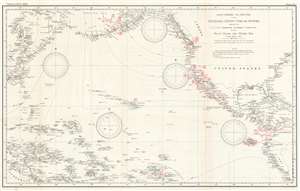
Chart Showing the Positions of the Dredgings Deeper than 100 Fathoms Made by the U.S. Fish Commission Steamship Albatross in the Pacific Ocean and Bering Sea from 1888 to 1900.
$400.00
Acquire
- Digital Map Information
- Suitable for large format printing
- File Size: 28.4 MB
- File Type: ZIP / TIFF
- ICC color profile embedded
- Delivered instantly via download link
This is a 1900 C. H. Townsend and U.S. Fish Commission map of Pacific Ocean floor samplings deeper than 100 fathoms. Red numbers identify these dredging locations and can be correlated with detailed data in USS Albatross archives. Stretching from Japan to North and South America and from the Bering Sea to Australia, Micronesia, and Polynesia, dredgings marked were collected by the Albatross between 1888 and 1900. (more details)