
Ratelband, Johannes

Johannes Ratelband (1715 - 1793) was a European map publisher based in Amsterdam. Ratelband is a rather obscure fellow, but is known to have published a series of European maps and views in association with the La Feuille family.
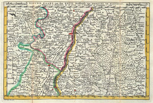
Nieuwe Kaart van den Rhyn, Strekkende van Fribourg tot Haguenau.
$225.00
Acquire
- Digital Map Information
- Suitable for large format printing
- DPI: 300
- File Size: 3.66 MB
- File Type: ZIP / TIFF
- ICC color profile embedded
- Delivered instantly via download link
A stunning map of Alcase, France drawn by J. Ratelband in 1735. Includes both Basse Alsace and Haute Alsace. Covers from Fribourg in the northwest, eastward past Strasbourg and the Rhine River as far as Rordorff and Kilberg. Dutch language title along the top ... (more details)
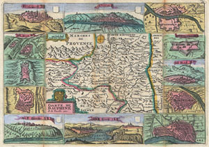
Caarte de Dauphine.
$225.00
Acquire
- Digital Map Information
- Suitable for large format printing
- DPI: 300
- File Size: 3.76 MB
- File Type: ZIP / TIFF
- ICC color profile embedded
- Delivered instantly via download link
A stunning map of Dauphine, France first drawn by Daniel de la Feuille in 1706. This province in southeastern France roughly corresponds with the modern day departments of Isère, Drôme, and Hautes-Alpes. Surrounded by twelve views of important villages and ... (more details)