
Reynolds, James

James Reynolds (1817-1876) was a London based map and chart publisher active in the mid-19th century. Reynolds produced numerous maps and tourist guides of London and the surrounding areas as well as various astronomical and scientific charts. After Reynolds retired his sons, William Henry and Frederick, took over his business, updating and reprinting many of his maps and charts before selling the firm to Charles Smith in the late 19th century. Reynolds operated out of office at 174 Strand Street, London.
Victorian London.
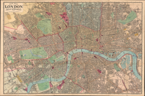
New Map of London with the Recent Improvements, 1874.
$500.00
Acquire
- Digital Map Information
- Suitable for large format printing
- Full resolution TIFF file
- ICC color profile embedded
- Delivered instantly via download link
This is a 1874 James Reynolds folding pocket city map or plan of London. It presents the city at the height of the Victorian era, when its infrastructure, including early underground railways, was developing rapidly to match its ballooning population. (more details)
Victorian London.
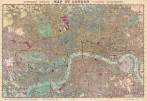
Reynolds's Distance Map of London, with the Recent Improvements.
$600.00
Acquire
- Digital Map Information
- Suitable for large format printing
- File Size: 121.48 MB
- File Type: ZIP / TIFF
- ICC color profile embedded
- Delivered instantly via download link
This is an 1887 James Reynolds city map of London. Centered on the Thames, coverage embraces London from Notting Hill and West Kensington to the West India Docks and the Isle of Dogs, and from Highbury and Kentish Town to Peckham and Battersea. A grid of quarter-mile squares is superimposed over the map, illustrating distances. Omnibus and tram-car routes are shaded yellow, while railroad stations are colored pink. Streets, parks, government buildings, rail stations, palaces, and churches are all labeled. Several specific sites are identified as well, including the British Museum, the Museum of Natural History, and the Royal Horticultural Gardens. (more details)