1887 Reynolds Pocket City Plan or Map of London, England
London-reynolds-1887$600.00

Title
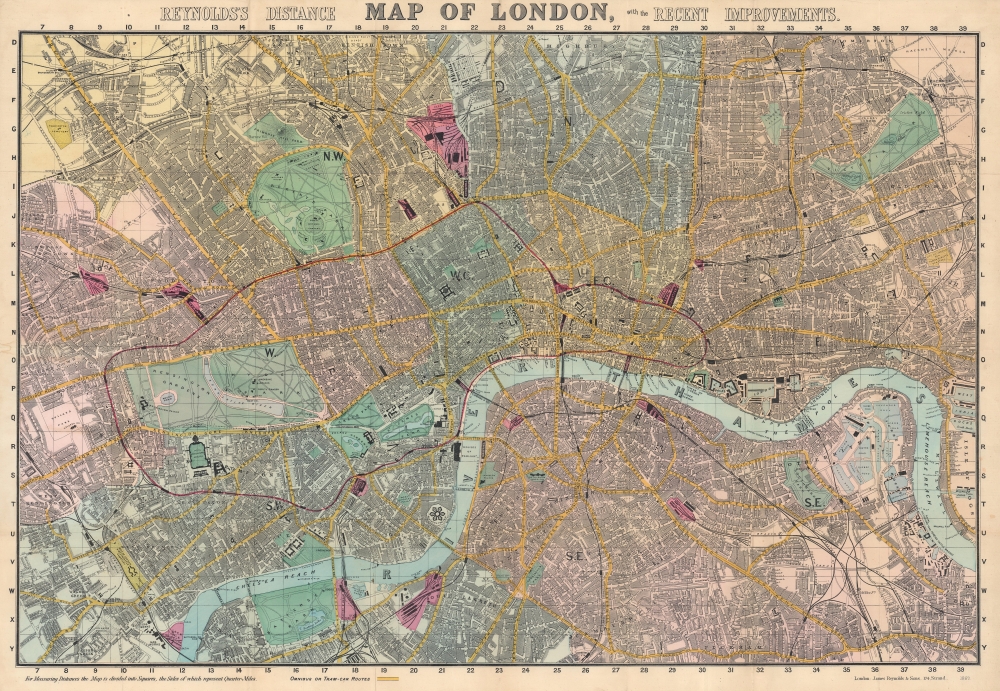
Reynolds's Distance Map of London, with the Recent Improvements.
1887 (dated) 20.75 x 29.75 in (52.705 x 75.565 cm)
1887 (dated) 20.75 x 29.75 in (52.705 x 75.565 cm)
Description
This is an 1887 James Reynolds city map of London. Centered on the Thames, coverage embraces London from Notting Hill and West Kensington to the West India Docks and the Isle of Dogs, and from Highbury and Kentish Town to Peckham and Battersea. A grid of quarter-mile squares is superimposed over the map, illustrating distances. Omnibus and tram-car routes are shaded yellow, while railroad stations are colored pink. Streets, parks, government buildings, rail stations, palaces, and churches are all labeled. Several specific sites are identified as well, including the British Museum, the Museum of Natural History, and the Royal Horticultural Gardens.
Publication History and Census
This map was created and published by James Reynolds and Sons in 1887. We note three cataloged examples of the 1887 edition in OCLC which are part of the collections at the University of Wisconsin - Milwaukee, Northern Michigan University, and the University of London Research Library Services Institute of Historical Research. Reynolds first issued this map in 1857 and it was updated annually to 1901, by which time Charles Smith and Sons had taken over the Reynolds firm.Cartographer
James Reynolds (1817-1876) was a London based map and chart publisher active in the mid-19th century. Reynolds produced numerous maps and tourist guides of London and the surrounding areas as well as various astronomical and scientific charts. After Reynolds retired his sons, William Henry and Frederick, took over his business, updating and reprinting many of his maps and charts before selling the firm to Charles Smith in the late 19th century. Reynolds operated out of office at 174 Strand Street, London. More by this mapmaker...
Condition
Very good. Mounted on linen. Light wear along original fold lines. Dampstaining only evident on verso.
References
OCLC 20908292.