
Roggeveen, Arent

Arent Roggeveen (1658 - November 27, 1679) was a Dutch hydrographer, cartographer, mathematician, poet, and astronomer active in the second half of the 17th century. Robgeveen was born in Delfshaven. Little is known of his education, but in 1658, he settled as a schoolmaster in Middleburg, seat of both the EIC and VOC. He later worked as a surveyor and a measurements expert in the wine industry - positions that made him reasonably wealthy. Around 1670, the VOC contracted him to compile and rectify their disparate archive of highly-secret sea charts. These were engraved and published in 1675 by Roggeveen and Pieter Goos. Roggeveen became obsessed with the notation of Terre Australis; a speculated continued occupying much of the southern hemisphere. In 1767, he received a patent from the Staten-Generaal to lead an expedition of discovery to the South Seas, but was unable to attract the necessary investment; it did not launch until the early 17th century, when his son, Jacob Roggeveen (1659 – 1729), made the voyage from 1721-22, in the process discovering Easter Island.
In Scarce Original Color.
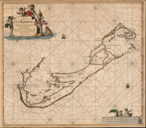
Pas Kaart van I. La Barmuda Anders Somer Islands int Groot Door Vooght Geometra.
$5,000.00
Acquire
- Digital Map Information
- Suitable for large format printing
- File Size: 24.21 MB
- File Type: ZIP / TIFF
- ICC color profile embedded
- Delivered instantly via download link
This is Johannes van Keulen's beautiful 1684 chart of Bermuda. This grand, desirable work is one of the earliest acquirable nautical charts of Bermuda; the present example is embellished with beautiful original color. (more details)
First published nautical chart of Bermuda.
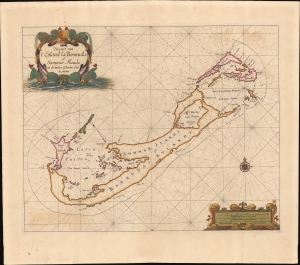
Pascaert van 't Eÿland la Bermuda of Sommer Ilands en de andere Eÿlanden daer bÿ geleeghen.
$25,000.00
Acquire
- Digital Map Information
- Suitable for large format printing
- File Size: 19.23 MB
- File Type: ZIP / TIFF
- ICC color profile embedded
- Delivered instantly via download link
This is a stunning old-color example of Arent Roggeveen's 1675 map of Bermuda, considered to be the first sea chart of the solitary archipelago. (more details)