
Sadahide Hashimoto (橋本貞秀)

Sadahide Hashimoto (橋本貞秀; ハシモト, サダヒデ; 1807 - 1878), also known as Gountei Sadahide (五雲亭貞秀) and Hashimoto Gyokuran (橋本玉蘭), was a Japanese artist active in Yokohama in the second half of the 19th century. He was born in Chiba Prefecture. Hashimoto is best known for his renderings of foreigners, in particular Western peoples and customs, as observed while living in the open port of Yokohama. He is considered to be a disciple of Takako Kunisada, another artist of the Toyokuni Utagawa school, earning him the name Utagawa Sadahide (歌川貞秀). Hashimoto met Kunisada in 1826, when he was 14 years old and most of his early work reflects the work of Kunisada. Even before the Bankumatsu period, Sadahide took an interest in distant and foreign lands, publishing an important and controversial account of the First Opium War between Britain and Qing China (Kaigai Shinwa, 海外新話) with the scholar Mineta Fūkō (嶺田楓江). Following the 'opening of Japan' in 1853, he produced a series of prints of Ainu people in Kita Ezo zusetsu (北蝦夷図説) as well as a world map that was likely based on a Dutch original (https://www.geographicus.com/P/AntiqueMap/world-mineta-1853), also with Mineta. He developed an interest in geography and began issuing maps and bird's-eye views, some quite large over multiple panels, of Japanese cities. At the very end of the Tokugawa period, he moved to Nagasaki and was selected as part of a Japanese delegation to the International Exposition of 1867. Sadahide died about a decade later, living long enough to see the rapid transofrmation of Japan following the Meiji Restoration. He was a mentor to Hideki Utagawa.
AKA: 橋本貞秀
Defending the borders in the wake of Commodore Perry.
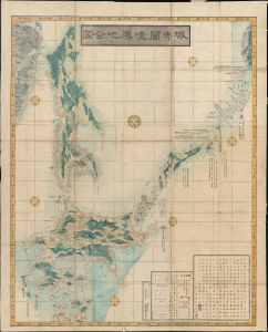
蝦夷闔境輿地全圖 / [Complete Map of All Lands within the Borders of Ezo].
$2,750.00
Acquire
- Digital Map Information
- Suitable for large format printing
- Full resolution TIFF file
- ICC color profile embedded
- Delivered instantly via download link
This is an important 1854 (Kaei 7) Japanese Edo period Fujita Ryou chromoxylographic map illustrating Hokkaido, Sakhalin, and the Kuril Islands. It was issued following the 1853 arrival of Commodore Matthew Perry, anticipating the opening of Hakodate as one of the five Japanese treaty ports. (more details)
Strategic Straits to Japan's Inland Sea.
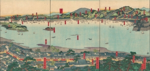
[Untitled] / ['View of Famous Places in the Western Inland Sea' (西国内海名所一覧)].
sold
- Digital Map Information
- Suitable for large format printing
- Full resolution TIFF file
- ICC color profile embedded
- Delivered instantly via download link
A scarce 1859 ukiyo-e triptych of the Kanmon Straits (also known as the Straits of Shimonoseki) where the islands of Honshu and Kyushu meet, produced by Sadahide, one of the most popular ukiyo-e artists of his time. (more details)
Yokohama's Yoshiwara.
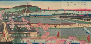
横浜港崎町大門橋真景 / [An Accurate View of the Miyozaki Great Gate and Bridge in Yokohama].
$3,500.00
Acquire
- Digital Map Information
- Suitable for large format printing
- Full resolution TIFF file
- ICC color profile embedded
- Delivered instantly via download link
This is a ukiyo-e triptych of Yokohama, prepared in 1860 by Sadahide, the master of the Yokohama-e subgenre of ukiyo-e woodblock prints. It depicts a view from the Miyozaki pleasure quarter, one of the main sites of cultural contact and mutual curiosity between foreigners and Japanese in Yokohama. (more details)
An Early View of Yokohama's Red-Light District.
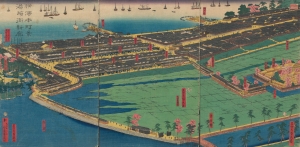
橫濱本町景港崎街新廓 / [View of Yokohama Honmachi and the New Miyozaki Quarter].
$3,000.00
Acquire
- Digital Map Information
- Suitable for large format printing
- Full resolution TIFF file
- ICC color profile embedded
- Delivered instantly via download link
This is a c. 1860 ukiyo-e triptych of Yokohama highlighting, among other elements, the Miyozaki Pleasure Quarter, prepared by Sadahide and published by Yamaguchiya Tōbei. The city, hitherto a small fishing village, rapidly developed after being opened to foreign traders and residents in 1859, building new districts, including Miyozaki, in a handful of months. (more details)
The Rapid Expansion of Yokohama.
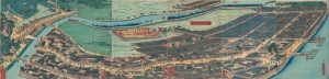
再改橫濱風景 / [Up-to-date View of Yokohama].
$4,000.00
Acquire
- Digital Map Information
- Suitable for large format printing
- Full resolution TIFF file
- ICC color profile embedded
- Delivered instantly via download link
This is a stunning 1861 panoramic set of six ukiyo-e (nishiki-e) Utagawa Sadahide woodblock prints depicting the port of Yokohama. The port opened to foreign trade in 1859, just two years earlier, becoming Japan's primary point of contact with the West. Sadahide was the most prolific among a school of woodblock artists chronicling these momentous changes. (more details)
American - Chinese - Japanese exchange in Yokohama.
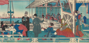
橫濱異人商館之圖 / [View of Foreign Merchant House in Yokohama].
$3,000.00
Acquire
- Digital Map Information
- Suitable for large format printing
- Full resolution TIFF file
- ICC color profile embedded
- Delivered instantly via download link
An absorbing 1861 depiction of Japanese-foreign interactions in Yokohama, this ukiyo-e triptych was prepared by Sadahide, the great chronicler of the treaty port in its early years, and published by Sanoya Kihei. It is notable, among other features, for revealing the three-way exchange between Westerners, Chinese, and Japanese in Yokohama. (more details)
Early Japanese connections with San Francisco.

亜墨利迦州迦爾波爾尼亜港出帆之圖 / [View of Ships Departing from the Port of California, America].
$4,000.00
Acquire
- Digital Map Information
- Suitable for large format printing
- Full resolution TIFF file
- ICC color profile embedded
- Delivered instantly via download link
A magnificent Ukiyo-e woodblock triptych in the distinctive Yokohama-e style, produced in 1862 by the genre's most prolific master, Utagawa Sadahide. It portrays a group of American ships leaving the 'port of California,' almost certainly San Francisco, presumably bound for Japan. This work is especially notable as it depicts a purely foreign scene, rather than the more common illustrations of foreigners in Yokohama or elsewhere in Japan. (more details)
Building and Rebuilding Yokohama.
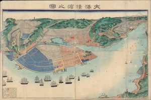
大港橫濱之圖 / [View of the Great Port of Yokohama].
$3,500.00
Acquire
- Digital Map Information
- Suitable for large format printing
- File Size: 53.59 MB
- File Type: ZIP / TIFF
- ICC color profile embedded
- Delivered instantly via download link
A scarce large-format c. 1868 view of Yokohama, prepared by Sadahide, master of the Yokohama-e genre of ukiyo-e woodblocks. It presents the extent of the port and hinterland a decade after it was opened to foreign trade, already expanding far beyond the small fishing village that had hitherto existed there. (more details)