
Shanghai Municipal Council (公共租界工部局)
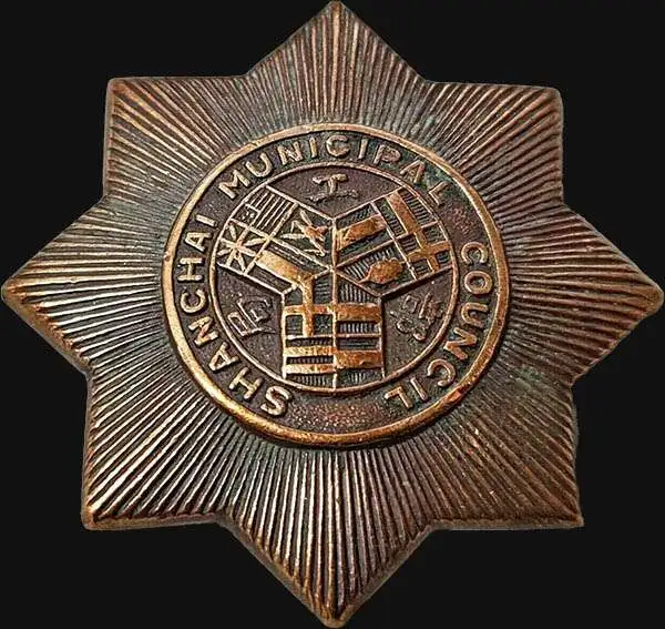
Shanghai Municipal Council (公共租界工部局; July 11, 1854 - 1943) was an organization of business leaders in Shanghai active from the middle part of the 19th century to the early 20th century. The organization was formed on July 11, 1854, by a group of influential Western businessmen who argued that Shanghai suffered under a lack of proper municipal governance. It laid down land regulations, began assisting in the construction of new roads, established refuse collection, and even initiated taxation. By the late 1860s, Shanghai's official governing body had been practically transferred from the individual concessions to the Shanghai Municipal Council (工部局). The British Consul was the de jure authority in the Settlement, but he had no actual power unless the ratepayers (who voted for the Council) agreed. Instead, he and the other consulates deferred to the Council, which was composed of 9 figures: 5 from the British Settlement, 2 from the American Settlement, and 2 from the Japanese Settlement. No Chinese were permitted to serve on the Council until 1928. By the 1880s, the Council acquired a virtual monopoly over city utilities, controlling gas suppliers, electricity producers, and water companies. Later, in the early 20th century, they also took control of rickshaws, tramways, and regulated opium sales and prostitution. The Council maintained its own police force, fire service, and military reserve, the Shanghai Volunteer Corps (萬國商團). The Municipal Council was disbanded in 1943, during World War II (1939 - 1945) when the Japanese closed all foreign concessions (except the French).
AKA: 公共租界工部局
First map of the American Concession in Shanghai?
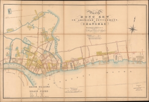
Plan of the Hong Kew (Hong Que.) or American Settlement, at Shanghae.
$19,000.00
Acquire
- Digital Map Information
- Suitable for large format printing
- File Size: 142.69 MB
- File Type: ZIP / TIFF
- ICC color profile embedded
- Delivered instantly via download link
A remarkable, rare, and highly detailed 1866 map of Hong Kew (Hongkou, 虹口区), or the American Concession in Shanghai - possibly the earliest known map to specifically illustrate the American Settlement. The map follows shortly after the formal establishment of the Concession and subsequent International Settlement in 1863 and details in manuscript the construction of subterranean drainage lines by the Shanghai Municipal Council. (more details)
First Municipal Council Maps - the origins of modern Shanghai.
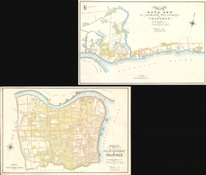
Plan of the English Settlement at Shanghae. / Plan of the Hong Kew (Hong Que.) or American Settlement, at Shanghae.
$45,000.00
Acquire
- Digital Map Information
- Suitable for large format printing
- Full resolution TIFF file
- ICC color profile embedded
- Delivered instantly via download link
The holy grail of Shanghai cartography, this 1866 map set is the most important, largest scale, and most beautiful early presentation of Shanghai. These are the first maps issued by the Shanghai Municipal Council, resulting from a landmark 1864-66 survey that followed the consolidation of the British Concession with the American Settlement. Their issue ended two decades of development lethargy and launched major urbanization and modernization projects that established Shanghai as the major gateway to China. As such, these maps, more than any other, represent the birth of Shanghai as a modern city. (more details)
Shanghai at the height of the 'Concession Period.'
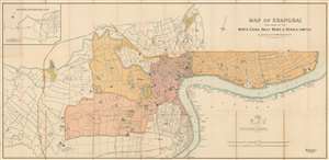
Map of Shanghai Published by the North-China Daily News and Herald, Limited.
$17,500.00
Acquire
- Digital Map Information
- Suitable for large format printing
- File Size: 62.63 MB
- File Type: ZIP / TIFF
- ICC color profile embedded
- Delivered instantly via download link
An extremely rare 1918 North-China Daily News and Herald map of Shanghai, China. Focusing on the Bund and the International Settlement, the map extends from the Shanghai Hangchow Ningpo Railroad in the west to Post Garden and the Standard Oil facility in the east. Derived roughly from the Municipal Council Map of the same year, this map is intensely detailed, with streets, businesses, clubs, parks, government offices, and civic institutions noted. Just outside the International Settlement boundary the Shanghai Jewish Club is noted. (more details)
Development of the Foreign Concessions in Shanghai.
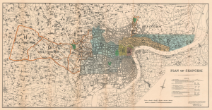
Plan of Shanghai.
$3,500.00
Acquire
- Digital Map Information
- Suitable for large format printing
- File Size: 46.42 MB
- File Type: ZIP / TIFF
- ICC color profile embedded
- Delivered instantly via download link
This is a rare 1928 large-format map of Shanghai, China, published by the Shanghai firm of Kelly and Walsh on behalf of the Shanghai Municipal Council. (more details)
Issued in the final days of Old Shangai just after the January 28 Incident or Shanghai Incident.
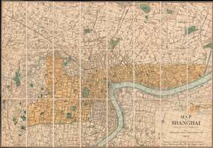
Map of Shanghai.
$9,000.00
Acquire
- Digital Map Information
- Suitable for large format printing
- File Size: 66.6 MB
- File Type: ZIP / TIFF
- ICC color profile embedded
- Delivered instantly via download link
An extremely rare 1933 North-China Daily News and Herald map of Shanghai. Focusing on the Bund and the International Settlement, the map extends from the Shanghai Hangchow Railroad in the west to the Shanghai Baptist College (now the University of Shanghai) in the east. Derived roughly from the Municipal Council Map of the same year, this map is in intensely detailed, with streets, businesses, clubs, parks, government offices, and civic institutions noted. This map was issued shortly after the 1932 Shanghai Incident in the final days of Shanghai's pre-war boomtime. (more details)