
St. Paul Lithograph and Engraving (St. Paul Lithographic)

St. Paul Lithograph and Engraving Co. (St. Paul Lithographic and Engraving Co.; fl. c. 1870 - 1891) was a lithographic printer active in St. Paul, Minnesota in the late 19th century. The firm primarily produced maps of the State of Minnesota and its major cities, including Minneapolis and St. Paul, working with a range of map publishers active in the state during the 1870s and 1880s. The firm was likely founded and for its known period of operation managed by one William Silcock, resident in St. Paul from about 1870 to 1900 and listed in city directories as a lithographer, printer, or transferer.
AKA: St. Paul Lithographic
Minnesota's Homesteader Population Boom.
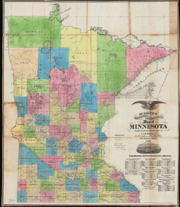
Burritt's Sectional and Township Map of Minnesota.
$1,800.00
Acquire
- Digital Map Information
- Suitable for large format printing
- Full resolution TIFF file
- ICC color profile embedded
- Delivered instantly via download link
This is Elijah H. Burritt and James B. Power's 1871 large-format map of Minnesota. It captures the state in the early post-Civil War period, when immigration from the eastern U.S. and Europe was fueling a period of tremendous growth. Burritt is better known for his popular celestial atlas; this is his only known terrestrial map. (more details)