
Stringer, William

William Stringer (fl. c. 1870 - 1875) was an editor and publisher based in Cleveland, Ohio.
Superior Street Viaduct - transforming Cleveland.
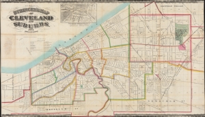
Stringer's Map of Cleveland and Suburbs.
$2,800.00
Acquire
- Digital Map Information
- Suitable for large format printing
- File Size: 2069.47 MB
- File Type: ZIP / TIFF
- ICC color profile embedded
- Delivered instantly via download link
This is an impressive 1873 William Stringer and Otto Dercum large-scale map of Cleveland, Ohio. The map was drawn to illustrate the Super Street Viaduct, a transformative infrastructure project that prompted a wave of urban expansion in the late 19th century. (more details)