
Tardieu, Pierre Antoine-François

Pierre Antoine-François Tardieu (February 17, 1757 - January 14, 1822), also known as Tardieu de l'Estrapade, for his address at Place de L'Estrapade, was a French geographical engraver and publisher active in Paris during the late 18th and early 19th centuries. A member of the large and prolific Tardieu family, which, for over 200 years, produced multiple skilled and active engravers. A disciple of his uncle Pierre-François Tardieu, in his youth Antoine-Francois would sign his works Pierre-François (or P.F. Tardieu; 1711 - 1771) , but later in his career began using his own name or (P.A.F. Tardieu). His two sons, Pierre-Antoine Tardieu and Ambroise Tardieu (1788 - 1841), both became noted geographical engravers in the own right.
Earliest printed depiction of the Kungur Ice Cave
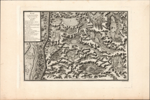
Plan et coupe horisontale du labyrinte souterrain de Koungour Renvoi.
$250.00
Acquire
- Digital Map Information
- Suitable for large format printing
- Full resolution TIFF file
- ICC color profile embedded
- Delivered instantly via download link
This is a fascinating cross-section view of the Kungur Ice Cave, a karst cave in the Ural Mountains, memorialized in Nicolas Gabriel Clerc's 1783 Histoire Physique, Morale, Civile et Politique de la Russie. Le Clerc was tasked by Louis XV to produce a history of Russia; his work included wonders such as this view of these sprawling caves, which to this day have not been fully explored. (more details)
First Full Map of Australia, and the First to name Sydney.
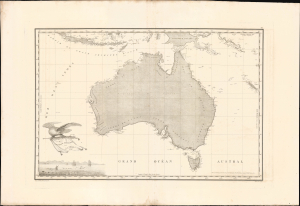
Carte Generale de la Nouvelle Hollande dressee par M L Freycinet Commandant La Goelette, Le Casuarina an 1808.
$8,500.00
Acquire
- Digital Map Information
- Suitable for large format printing
- Full resolution TIFF file
- ICC color profile embedded
- Delivered instantly via download link
This landmark 1811 map of Australia by French explorer and cartographer Louis de Freycinet is celebrated as the first published map to depict the continent's complete coastline and the first to identify Sydney by name. Based on surveys conducted during Nicolas Baudin's French expedition to Australia aboard the Géographe and Naturaliste (1801 - 1803), it presents the continent as Nouvelle Hollande and preserves the expedition's politically charged French nomenclature, including Terre Napoléon. Issued three years before Matthew Flinders' competing map, Freycinet's chart represents a defining achievement in the exploration, mapping and naming of Australia. (more details)
First map of South Australia: politically charged French toponymy.
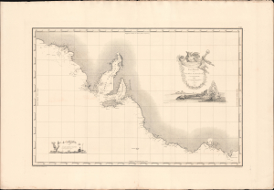
Carte Générale de al Terre Napoléon (À la Nouvelle Holland.)
$3,000.00
Acquire
- Digital Map Information
- Suitable for large format printing
- Full resolution TIFF file
- ICC color profile embedded
- Delivered instantly via download link
This landmark 1811 map of South Australia, including modern-day Adelaide and Melbourne, by French explorer and cartographer Louis de Freycinet. Based on surveys conducted during Nicolas Baudin's expedition to Australia aboard the Géographe and Naturaliste (1801 - 1803), it presents South Australia with politically charged French nomenclature, including, as here, Terre Napoléon. Issued three years before Matthew Flinders' competing map, Freycinet's chart represents a defining achievement in the exploration, mapping and naming of South Australia. (more details)
New England during the War of 1812.
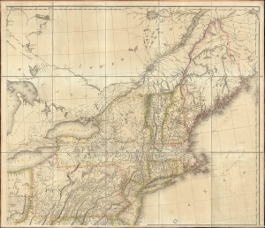
[New England].
$1,000.00
Acquire
- Digital Map Information
- Suitable for large format printing
- File Size: 36.52 MB
- File Type: ZIP / TIFF
- ICC color profile embedded
- Delivered instantly via download link
The northeastern sheet of Pierre Francois Tardieu's 1812 four-sheet map of the United States of America, based on Aaron Arrowsmith's seminal 1796 map of the same. Its publication coincided with the outbreak of the War of 1812 (1812 - 1815). Aside from its aesthetic qualities and level of detail, the map is notable for demonstrating the territorial evolution of the new republic. (more details)