
Teixeira, Luís

Luís Teixeira (1564 - 1604) was a Portuguese Jesuit cartographer, and mathematician. He had two sons, also cartographers. Little is known of his life and education, but he would be highly placed: he became cartographer to the Spanish Crown. His work would be widely disseminated, especially in the maps of Ortelius, Hondius and their successors. His map of Japan, published by Ortelius, would be the first detailed separate map of the island. His charts also informed the mapping of Brazil, and of the African coast.
Richly-Engraved Guinea Coast.
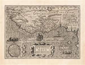
Guineae Nova Descriptio.
$550.00
Acquire
- Digital Map Information
- Suitable for large format printing
- DPI: 600
- File Size: 69.97 MB
- File Type: ZIP / TIFF
- ICC color profile embedded
- Delivered instantly via download link
This is Jodocus Hondius' 1606 map of the Guinea coast of Africa, stretching from the mouth of the Senegal River to Cape Lopez, from modern Senegal to Benin. It shows this coast at a time when its trade was largely controlled by the Portuguese, with whom the Dutch were at war; this map thus presented to a Dutch audience what would have been considered a rich prize to be taken. (more details)
Insular Korea.
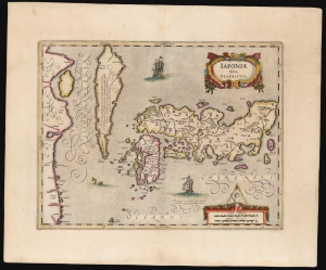
Japoniae nova Descriptio.
$2,500.00
Acquire
- Digital Map Information
- Suitable for large format printing
- Full resolution TIFF file
- ICC color profile embedded
- Delivered instantly via download link
This is a scarce. original-color example of Jan Jansson's map of Japan and Korea, featuring an insular Korea. The map follows the model of Luís Teixeira, the 16th-century court cartographer to the King of Spain. (more details)