
Thornton, John

John Thornton (October 8, 1641 - January 23, 1708) was a British chartmaker, sea captain, publisher and engraver active in London during the late 18th and early 19th centuries. Thornton apprenticed to John Burston where mastered the art of manuscript maritime cartography as practiced by the Thames School. By the 1660s Thornton, working with John Seller and William Fisher, began publishing printed nautical charts and was the only Thames School cartographers to successfully transition to print. Thornton published numerous maps both independently and with some of the most prominent British publishers of his day, including the aforementioned as well as Herman Moll, Robert Morden, James Clark, Robert Greene, and Philip Lea. From around 1665 Thornton took over from Seller the production of the English Pilot. Upon his death in 1708 Thornton willed his charts, copper plates, instruments, and 'all things belonging to my calling' to his son, Samuel Thornton, who continued to republished his father's work, with few updates, until about 1715.
Earliest Printed, Accurate Chart of the Source of London's Coffee.
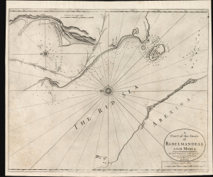
A Chart of the Straits of Babelmandell and Moha.
$2,000.00
Acquire
- Digital Map Information
- Suitable for large format printing
- Full resolution TIFF file
- ICC color profile embedded
- Delivered instantly via download link
This is John and Samuel Thornton's scarce c. 1703/1707 chart of Bab el Mandab, the Strait of Mandeb, or 'the Gate of Lamentation.' For centuries, this has represented a chokepoint between the Arabian Peninsula and the Horn of Africa and also forms a strategic bottleneck between the Red Sea and the Gulf of Aden. The present chart is the first of the Strait to benefit from a firsthand survey at a time when this region supplied most of Europe's coffee. (more details)
Important State of the dominant chart of Colonial Virginia.
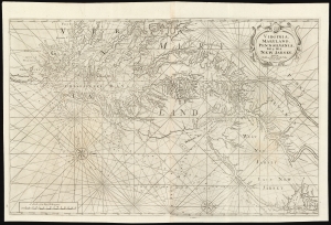
Virginia, Maryland, Pennsilvania, East and West New Jarsey...
$4,000.00
Acquire
- Digital Map Information
- Suitable for large format printing
- DPI: 600
- File Size: 89.65 MB
- File Type: ZIP / TIFF
- ICC color profile embedded
- Delivered instantly via download link
This is a superb example of William Mount and Thomas Page's large nautical map of the Chesapeake Bay and Delaware Bay in the 1742 first state. It represents the dominant English depiction of the water approaches to Virginia, Maryland, Delaware, and New Jersey for most of the Colonial Period. (more details)
South Carolina at the end of the French and Indian War.
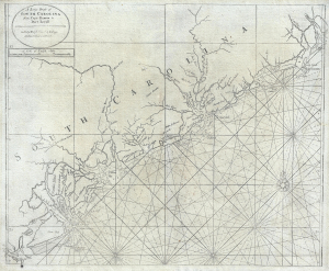
A Large Draft of South Carolina from Cape Roman to Port Royall.
$4,500.00
Acquire
- Digital Map Information
- Suitable for large format printing
- Full resolution TIFF file
- ICC color profile embedded
- Delivered instantly via download link
A rare 1763 Mount and Page nautical chart or maritime map of the coast of South Carolina issued at the end of the French and Indian War (1754 - 1763). Centered on Charleston (Charles Town), the map covers from the Santee River and Cape Romain (Cape Roman) to Hilton Head and Port Royal - a prosperous area covering the main ports of the cotton and tobacco trade. The cartographer notes various Indian and European Settlements, including the Scotts Settlements, Sr. Peter Colleons Signory, the Edestow Settlements (Edisto Settlements), the site of a Sewee Indian village, and more. There are soundings along much of the coastline, but particularly concentrated around Charleston and Port Royal (more details)