
La Touanne, Edmond Bigot de

Edmond Bigot de la Touanne (May 3, 1796 - October 27, 1863) was a French topographical artist and naval officer. La Touanne served as a lieutenant on Hyacinthe de Bougainville's voyage around the world in 1824 - 1826. The French government had given Bougainville secret orders to scout the defenses of British settlements in the South Seas. Thus, while they were in Port Jackson, La Touanne, Bougainville, and other expedition members extensively explored the colony, and La Touanne created a detailed map of Port Jackson. In 1828, La Touanne published a folio of 35 lithographic views relating to the voyage entitled Album Pittoresque de la Frégate La Thétis et de la Corvette l'Espérance. In 1837, when Bougainville's Journal of the expedition was published, all 56 of its lithographed plates, views, and maps were done after La Touanne's work.
Among the first maps of the Anambas Islands.
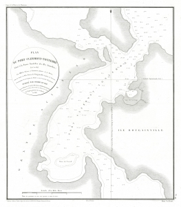
Plan du Port Clermont-Tonnerre Situé à la Partie Nord-Est des Iles Anambas.
$700.00
Acquire
- Digital Map Information
- Suitable for large format printing
- File Size: 10.86 MB
- File Type: ZIP / TIFF
- ICC color profile embedded
- Delivered instantly via download link
This is an 1828 Ambroise Tardieu map of the northeastern part of Siantan Island in the Anambas Islands Regency, part of the Riau Archipelago in Indonesia. Bougainville's expedition marks the first European reconnaissance of the Anambas Islands. (more details)
Bali's Lesser-Known Neighbor.
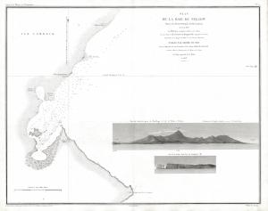
Plan de la Baie de Peejow Située à la Partie Orientale de l'Ile Lombock.
$800.00
Acquire
- Digital Map Information
- Suitable for large format printing
- File Size: 14.86 MB
- File Type: ZIP / TIFF
- ICC color profile embedded
- Delivered instantly via download link
This is an 1837 Ambroise Tardieu nautical chart of the Bay of Peejow on the east coast of the island of Lombok in Indonesia. (more details)
Tracing the first European exploration of the Anambas Islands.
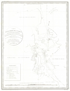
Carte d'une Partie des Anambas Reconnue Par M. le Baron de Bougainville.
$750.00
Acquire
- Digital Map Information
- Suitable for large format printing
- File Size: 9.67 MB
- File Type: ZIP / TIFF
- ICC color profile embedded
- Delivered instantly via download link
This is an 1828 Ambroise Tardieu map of the northeastern part of Siantan Island and the surrounding islands in the Anambas Islands Regency, part of the Riau Archipelago in Indonesia. Bougainville's expedition marks the first European reconnaissance of the Anambas Islands. (more details)
Defending the Dutch East Indies against the British.
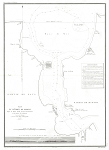
Plan du Détroit de Madura depuis la Pointe Panka jusqu'a l'Embouchure de la Rivière de Sourabaya.
$1,000.00
Acquire
- Digital Map Information
- Suitable for large format printing
- Full resolution TIFF file
- ICC color profile embedded
- Delivered instantly via download link
This is an 1837 Ambroise Tardieu map of the Madura Strait between the islands of Java and Madura in Indonesia. (more details)