
Treskot, Ivan Fomic (Иван Фомич Трускотт)

Ivan (Johann) Fomic Treskot (Иван Фомич Трускотт; December 1, 1721 - May 18, 1786), also spelled Treskott, Truscott, or Truskot, was a Russian cartographer active in St. Petersburg in the late 18th century. Treskot was born in St. Peterburg, the son of an English merchant (perhaps the reason his name is sometimes recorded as John Truskott). He studied architecture and cartography at the Russian Academy of Sciences under Joseph-Nicolas De l'isle (April 4, 1688 – September 11, 1768) and Jacob Friedrich Schmidt (Якоб Фридрих Шмидт; 1723 - 1786). In 1746 he was made head of the Cartographic Department at the St. Petersburg Academy of Sciences. They went on to compile a detailed mapping of Siberia, publishing various regional maps from 1770 to 1776. Working with Schmidt, Treskot compiled the 1784 Tabula Geographica Generalis Imperii Russici, the finest general map of the empire since after the 1734 Kirilov. Treskot was active at the Russian Academy's Geographical Department for nearly 50 years, from 1737 to his death in 1786. While he supervised the construction of hundreds of maps, only 11 of which bear his imprint.
AKA: Иван Фомич Трускотт
Siberia Revealed: An Empire Mapped at Monumental Scale.
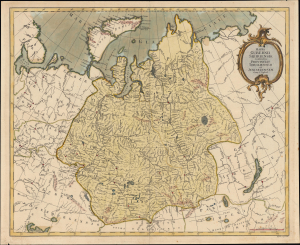
Mappa Gubernii Sibiriensis, continens procincias Toboliensem et Jenisejensem.
$900.00
Acquire
- Digital Map Information
- Suitable for large format printing
- Full resolution TIFF file
- ICC color profile embedded
- Delivered instantly via download link
This is a c. 1775 Ivan Treskot map of the Siberia Governorate, one of the great achievements of 18th-century Russian imperial cartography. Produced as part of the ambitious 1770 - 1776 project undertaken by Treskot and Jacob Friedrich Schmidt to remap Siberia, it synthesizes Russia's rapidly expanding regional geographical knowledge. Stretching from the Arctic Ocean to the Central Asian steppe and from European Russia nearly to Lake Baikal, the map reveals Siberia not as an empty wilderness, but as an increasingly organized imperial landscape structured around immense river systems, fortified settlements, and expanding networks of Russian administration. (more details)
Russia's expanding empire.
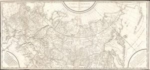
Carte Générale de L'Empire de Russie 1787.
$650.00
Acquire
- Digital Map Information
- Suitable for large format printing
- DPI: 600
- File Size: 1259.31 MB
- File Type: ZIP / TIFF
- ICC color profile embedded
- Delivered instantly via download link
An intricate large-scale c. 1787 French-language map of the Russian Empire engraved by Pierre-François Tardieu. It represents a significant improvement on earlier maps of the empire, especially its eastern portions and the northern Pacific, as both Russian and western European voyages of exploration proliferated in the late 18th century. (more details)