
Turner, William John

William John Turner (fl. c. 1876 - 1892) was an English cartographer and geographer who operated in London during the late 19th century. Turner was officially employed by the Royal Geographical Society as a cartographer beginning on November 15, 1873 and accepted the post of 'Map Draughtsman and Assistant Curator' on June 29, 1877. Also in 1877, Turner began advocating for the 'in-house' creation of all maps published in the 'Journal of the Royal Geographical Society'. In May 1878, acting on his advice, Turner was given the post of 'Chief Draughtsman' for in-house cartography. Turner left the Royal Geographical Society in 1881 to work for A.K. Johnston. Turner left the Johnston firm in December 1886, and, after a time, was employed by the Royal Geographical Society from May 1887 until May 1889 'construction wall maps etc.' and 'contoured maps'. Later he partnered with W. Shaweto found 'Turner and Shawe', lithographers working for the RGS. The 'Turner and Shawe' imprint was active until at least 1904.
Traces the 1877 expedition of British Army officer William John Gill.
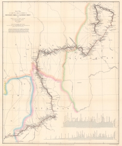
Route Map of Captain W. J. Gill's Journey in Western China and Eastern Tibet.
$850.00
Acquire
- Digital Map Information
- Suitable for large format printing
- File Size: 16.95 MB
- File Type: ZIP / TIFF
- ICC color profile embedded
- Delivered instantly via download link
This is a scarce and important 1878 William John Turner map of western China and eastern Tibet tracing Captain William John Gill's 1877 expedition through the region. (more details)
One of the first western maps of Xinjiang, China, illustrating a Great Game Era British trade mission.
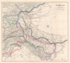
Map of Central Asia to accompany the Paper by Captain H. Trotter R.E., on the Geographical Results of Sir T.D. Forsyth's Mission to Kashgar, 1873 - 74.
$950.00
Acquire
- Digital Map Information
- Suitable for large format printing
- File Size: 24.76 MB
- File Type: ZIP / TIFF
- ICC color profile embedded
- Delivered instantly via download link
This is a 1878 William John Turner and Royal Geographical Society map of Xinjiang, China, that traces explorations of the 1873 - 1874 Forsyth Mission, making this one of the first detailed Western maps of the region. The map is a relic of the Great Game, a series of struggles between Britain and Russia to control Central Asia. (more details)