
Williams, William G.

William G. Williams (1801-1846) served in the U.S. Army from 1820 until 1846. He graduated from the U.S. Military Academy at West Point and, after graduation, served on topographical cut, eventually reaching the rank of Captain. He oversaw the survey for the proposed canal around the Falls of Niagara, New York and on Lake Champlain, New York. He served as Superintendent of Survey of Northwestern Lakes from 1841-1846. The Mexican-American War broke out in 1846, where he served as the Chief Topographical Engineer of the Army commanded by Major General Taylor until September 21, 1846 when, fighting in the Battle of Monterey, he was mortally wounded and died of his wounds. He is buried in Buffalo, New York.
Niagara Falls! A fifth potential route for the canal - requested by a committee from Lockport, N.Y.
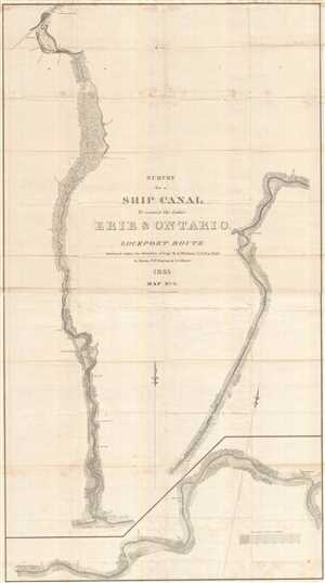
Survey for a Ship Canal to connect the Lakes Erie and Ontario. Lockport Route.
$450.00
Acquire
- Digital Map Information
- Suitable for large format printing
- DPI: 300
- File Size: 30.1 MB
- File Type: ZIP / TIFF
- ICC color profile embedded
- Delivered instantly via download link
This is a stunning and important 1835 William G. Williams map of Line No. 5 for the proposed canal connecting Lake Erie and Lake Ontario. The map depicts a route 'from the mouth of Eighteen-mile creek to the outlet of the Tonnewanta, on the Niagara [R]iver.' The ... (more details)
Niagara Falls! Depicts both sets of double locks in detail along with a profile diagram of a lock.
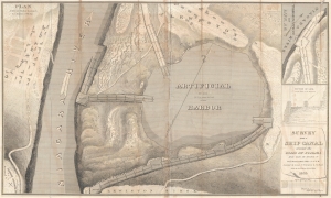
Survey for a Ship Canal around the Falls of Niagara. Plan Artificial Harbor and Project for Descent of Ridge.
$250.00
Acquire
- Digital Map Information
- Suitable for large format printing
- DPI: 300
- File Size: 46.22 MB
- File Type: ZIP / TIFF
- ICC color profile embedded
- Delivered instantly via download link
This is the 1835 William G. Williams map of a proposed artificial harbor to be used in conjunction with two of the proposed routes for a canal between Lake Erie and Lake Ontario. The harbor was ultimately constructed and is now the Niagara Water Reservoir. The map depicts the area from Queenston, Ontario, to just to the right of the proposed artificial harbor and from Lewiston, New York, to Lewiston Ridge, which the canal would have to descend. (more details)