
Yoshida Hatsu Saburo
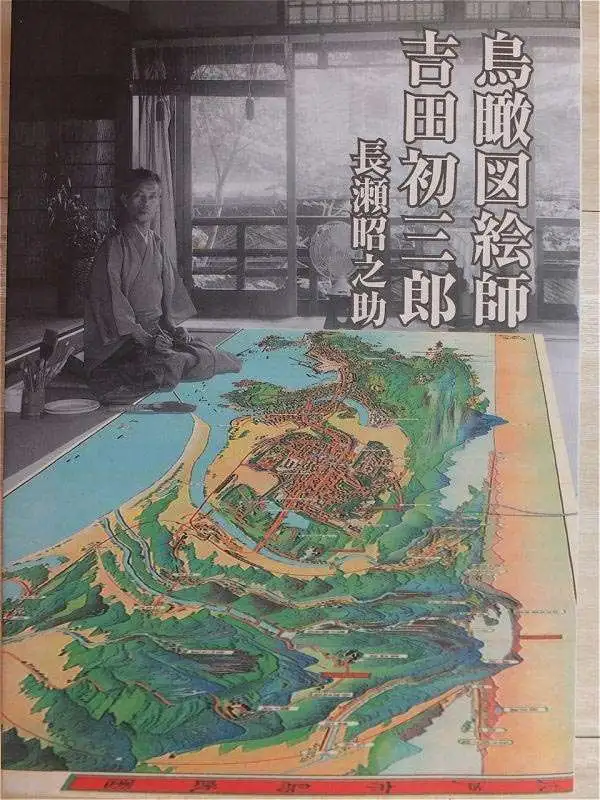
Yoshida Hatsusaburō (吉田初三郎, March 4, 1884 - August 16, 1955) was a Japanese illustrator and painter of birds-eye views active during the Taisho and Showa periods. Yoshida was born in Kyoto and apprenticed under Takeshiro Kanokgoi (1874 - 1941). Yoshida is significant for pioneering the use parallel perspective birds-eye views to illustrate Japanese bus and railroad transit networks. His first birds-eye view, completed in 1914, illustrated the Keihan railway and was highly praised by no less than Hirohito, then a prince but soon to be the Shōwa Emperor. With the Emperor's approval, Yoshida's views became widely popular and were adopted by the Ministry of Railways for the illustration all of its major public transportation networks. His style was so fashionable and distinctive that an entire genre was named after him (初三郎式絵図), and his works helped to spur a domestic tourism boom in the 1920s – 1930s. Most of his work consisted of city and regional views, though larger views encompassing the entirety of Japan do exist. Yoshida's most significant piece is most likely his rendering of the Hiroshima bombing, which was published in an English language magazine in 1949. He took on Tsunemitsu Kaneko as an assistant and apprentice in the early 1930s. Eventually Kaneko started making parallel perspective views of his own and became Yoshida's primary rival. Although he made over 3,000 maps in his lifetime, Yoshida was known to dedicate months to research and preparation for particular maps. For his 1949 Hiroshima map and his striking depiction of the Great Kanto Earthquake of 1923, he adopted a journalistic approach and spoke to many survivors of the disasters.
Interwar Japan's Impressive Rail Network.
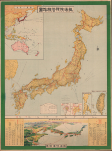
鐵道院所管線路圖 / [Map of Railway Lines Managed by the Imperial Railway Board].
$900.00
Acquire
- Digital Map Information
- Suitable for large format printing
- Full resolution TIFF file
- ICC color profile embedded
- Delivered instantly via download link
This is a large-format wall map depicting Japan's railway network, produced in 1918 by the Imperial Railway Board and published by the Toppan Printing Company. It demonstrates the country's sizable and growing rail network and hints at its larger ambitions to build close connections with the rest of East Asia. (more details)
Panoramic Bird's-Eye View of Japan.

日本交通鳥瞰圖 / [Bird's Eye View of Japan's Transportation].
$550.00
Acquire
- Digital Map Information
- Suitable for large format printing
- Full resolution TIFF file
- ICC color profile embedded
- Delivered instantly via download link
This is a stunning, large-format 1922 Yoshida Hatsusaburo foldout bird's-eye view of Japan, produced for the Japanese Ministry of Railways. It highlights the country's transportation links, particularly railways, which were the primary means of interurban travel, while also celebrating the 1922 Tokyo Peace Exhibition. (more details)
Taking in the view of Mt. Fuji.

長岡古奈温泉名所圖繪 / [View of the Famous Onsen of Nagaoka and Kona].
$400.00
Acquire
- Digital Map Information
- Suitable for large format printing
- Full resolution TIFF file
- ICC color profile embedded
- Delivered instantly via download link
This is a scarce 1922 Yoshida Hatsusaburō bird's-eye view of Nagaoka on the Izu Peninsula in Shizuoka Prefecture. The view and the information on the verso focus on the area's hot springs (onsen), which became a popular tourist attraction in the years just prior to publication, in part due to the views of Mt. Fuji one could enjoy in Nagaoka. (more details)
Remarkable Cormorant Fishing tradition.
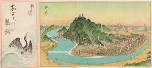
ながら川の鵜飼 / [Cormorant Fishing on the Nagara River].
$400.00
Acquire
- Digital Map Information
- Suitable for large format printing
- Full resolution TIFF file
- ICC color profile embedded
- Delivered instantly via download link
This is a charming c. 1925 bird's eye view of Gifu (岐阜) by Yoshida Hatsusaburo, a leading producer of views from this era. The view focuses on the famous practice of cormorant fishing in Gifu, a traditional means of gathering food that by this time had already transitioned to being primarily a tourist attraction. (more details)
Guide to Japan's Historical Heartland.
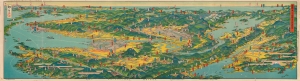
近畿を中心とせる名勝交通大鳥瞰圖 / [A Bird's-Eye View of Scenic Spots and Transportation Centered on the Kinki Region].
$500.00
Acquire
- Digital Map Information
- Suitable for large format printing
- Full resolution TIFF file
- ICC color profile embedded
- Delivered instantly via download link
A stunning 1926 bird's-eye view of the Kansai region of Japan drawn by Yoshida Hatsusaburō and published in Osaka Mainichi Shimbun. Both beautiful and functional, the view and its verso provide a comprehensive guide for tourists and travelers to the region. (more details)
Japan's Mountainous Southern Island.
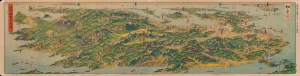
日本鳥瞰九州大圖繪 / [Bird's Eye View of Japan - Large Illustrated Map of Kyushu].
$500.00
Acquire
- Digital Map Information
- Suitable for large format printing
- Full resolution TIFF file
- ICC color profile embedded
- Delivered instantly via download link
A spectacular bird's-eye view of Kyushu, the southernmost of Japan's home islands, drawn by Yoshida Hatsusaburō and published in the Osaka Mainichi Shimbun in 1927. It thoroughly overviews the mountainous island, its transportation network, many culturally significant sites, and leisure destinations. (more details)
12,000 Peaks of Mt. Kumgang.
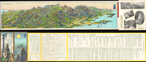
朝鮮金剛山交通大鳥瞰圖 / [Large Bird's Eye View of Transportation to Korea's Mt. Kumgang].
$500.00
Acquire
- Digital Map Information
- Suitable for large format printing
- File Size: 95.55 MB
- File Type: ZIP / TIFF
- ICC color profile embedded
- Delivered instantly via download link
This is a striking large-format 1929 panoramic pictorial view of Mt. Kumgang, Korea, produced in the Japanese colonial period by the era's greatest view artist, Yoshida Hatsusaburō. In addition to highlighting the area's stunning natural beauty, it also reflects its appropriation by Japan as a colonial tourist site. (more details)
Archetypal views from the early Showa era.

日本八景名所圖繪 / [Drawing of the Eight Famous Scenic Views of Japan].
$1,500.00
Acquire
- Digital Map Information
- Suitable for large format printing
- Full resolution TIFF file
- ICC color profile embedded
- Delivered instantly via download link
This is a beautiful 1930 (Shōwa 5) set of views of scenic sites in Japan drawn by Yoshida Hatsusaburō, the most prominent artist of views in Japan at the time. It was published as a supplement to Housewife's Friend (主婦の友), a popular monthly women's magazine. The views show the 'New' Eight Views of Japan, a cultural phenomenon at the intersection of national identity (or nationalism), mass media, mass consumption, and tourism, all of which flourished in this period. (more details)