
Bridgman, Erastus Clark

Erastus Clark Bridgman (October 31, 1817 - August 25, 1870) was a New York City based map publisher active in the middle of the 19th century. Bridgman was born in Westhampton, Massachusetts. He was in South Carolina in 1849, where his first child was born, but moved to New York City by 1850. Bridgman was in partnership with Edward H. Ensign (1818 - 1871) and Horace Thayer from 1850 - 1852, publishing under the imprint of 'Ensign, Thayer, and Co.' Later, from 1854 - 1863, the partnership changed to Edward H. Ensign, Thomas C. Fanning (1805 - 1873), and Bridgman, publishing as 'Ensign, Bridgman and Fanning.' After his death, the Bridgman firm was taken over by his son Edward Clark Bridgman (1849 - 19??).
The United States - fully formed.
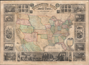
Pictorial Map of the United States.
$3,000.00
Acquire
- Digital Map Information
- Suitable for large format printing
- File Size: 1717.2 MB
- File Type: ZIP / TIFF
- ICC color profile embedded
- Delivered instantly via download link
A decorative 1855 wall map of the United States. Issued by Ensign, Bridgman and Fanning, this map covers from Atlantic to Pacific and from Canada to the Gulf of Mexico. This map illustrates an ephemeral period in the development of the American West with each of its many editions exhibiting significant changes and updates. (more details)
Evolving Geography of a Metropolis.
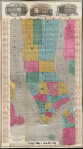
Fanning's Map of New-York City.
$1,500.00
Acquire
- Digital Map Information
- Suitable for large format printing
- File Size: 27.12 MB
- File Type: ZIP / TIFF
- ICC color profile embedded
- Delivered instantly via download link
An example of Thomas Fanning's 1855 map of New York City. Among several interesting features, it is most notable for including presumed future development, including in the central part of Uptown Manhattan, some of which in the process of being designated for Central Park. (more details)
Wipe the sweat from your brown and navigate the elevated train!
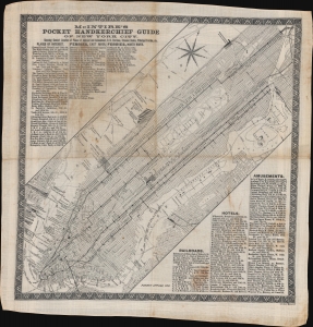
McIntire's Pocket Handkerchief and Guide of New York City.
$1,900.00
Acquire
- Digital Map Information
- Suitable for large format printing
- File Size: 28.99 MB
- File Type: ZIP / TIFF
- ICC color profile embedded
- Delivered instantly via download link
This is a rare c. 1869 Bridgman and McIntire pocket guide map of New York City. It follows shortly after the development of New York's Elevated Train System - the city's first viable public transportation and the precursor of the modern system. Straphangers need a practical guide, and what could be better than the 'weatherproof,' 'tearproof,' and utilitarian handkerchief map - wipe the sweat from your brow and find your way! Published as 'McIntire's Pocket Handkerchief Guide of New York City,' the map depicts Manhattan from the Battery north to West 155th Street and the southern Bronx. (more details)