
Chardon, Charles

Charles Chardon (1832 - May 24, 1896) was a Paris, France, based printer and publisher active in the late 19th century. The firm was originally founded in 1818 by Chardon the elder on Rue Pierre-Sarrazin. Around 1835 he relocated to Rue Hautefeuille. In 1850 the firm was passed to Francois Chardon, his eldest son, and then in 1862 to Charles Chardon, his younger son. Charles relocated the firm to larger offices at 10, Rue de l'Abbaye. By 1880 Charles Chardon, from his office at 10 Rue de l'Abbaye, was promoting himself as a heliographic engraver - an early photoengraving technique of which he was an early adopter. Possibly because of his heliographic press, Chardon was contracted to produce numerous prints from drawings stored at the Chalcographie of the Louvre. Francois Chardon passed the firm to Charles Wittmann in 1890. Continuing in Chardon's tradition, in 1896 Wittmann become the director of the Louvre's Chalcographie.
1st year of the French Second Republic.
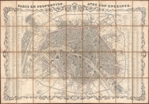
Paris en Proportion avec son enceinte.
$950.00
Acquire
- Digital Map Information
- Suitable for large format printing
- Full resolution TIFF file
- ICC color profile embedded
- Delivered instantly via download link
This is a strikingly decorative 1849 Charles Dyonnet city plan or map of Paris, France. Published during the first year of the French Second Republic (1848 - 1852), the map details Paris, highlighting its buildings, parks, avenues, and other sites. Among these are the Jardin des Tuileries, the Champs- Élysées, the Louvre, the Palais du Luxembourg, the Jardin du Luxembourg, and Père Lachaise Cemetery. Streets and avenues are illustrated and labeled throughout. Train stations are illustrated, and rail lines are highlighted. Paris is surrounded by the recently completed Thiers Wall with its 94 bastions numerically identified. An alphabetic street index appears to the left and right, while an index of theaters, town halls, libraries, and museums occupies the upper right. The whole is surrounded by a arresting acanthus border. (more details)
Beginning of the Haussmann Renovations.
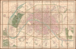
Plan de Paris Fortifié et des Communes Environnantes.
$1,750.00
Acquire
- Digital Map Information
- Suitable for large format printing
- File Size: 127.53 MB
- File Type: ZIP / TIFF
- ICC color profile embedded
- Delivered instantly via download link
This is a stunning 1856 Longuet city plan or map of Paris, France, during the reign of Napoleon III and the Second French Empire. The map illustrates the early stages of the Georges-Eugène Haussmann Renovations of Paris, which took place from 1853 - 1870. (more details)