
Jode, Cornelis De

Cornelis de Jode (1568 – October 17, 1600) was an Antwerp cartographer, engraver and publisher, He was the son and heir of Gerard de Jode, also a cartographer and publisher. Cornelis studied science at Academy of Douai, but it can be understood that his main education in the trade was at the hands of his father. On his father's death in 1591, Cornelis de Jode took over the work on his father's atlas, Speculum Orbis Terrarum. This had enjoyed publication in a single edition of 1578, overshadowed by the competition posed by Abraham Ortelius' (1527 - 1598) Theatrum Orbis Terrrum. Cornelis published a second edition, to which he added many updated maps to bring the work up to date with its competition. Despite the improvements brought to the atlas, both aesthetic and geographic, De Jode was unable to break Ortelius' grip on the market and there were no further editions of the atlas. After his death, the engraving plates were sold to Ortelius' executor Johannes Baptista Vrients (1552 - 1612), who was continuing to publish the Theatrum. Vrients would utilize several decorative plates from the Speculum, but the complete work and its maps were not published again - likely they were destroyed by Vrients to keep them from competing with his editions of the i>Theatrum.
First Atlas Map dedicated to Scandinavia.
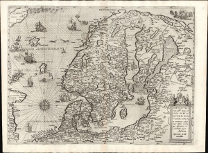
Septentrionaliū Regionum Suetiae Gothiae Norvegiae Daniae et terrarium adiacētium recens exactaque description per Livinum algoet Auctorem Gerardus de Jode excudebat.
$12,000.00
Acquire
- Digital Map Information
- Suitable for large format printing
- Full resolution TIFF file
- ICC color profile embedded
- Delivered instantly via download link
This is Gerard De Jode's rare map of Scandinavia, the first folio map specifically focused on the area, in its 1593 edition published by the younger De Jode, Cornelis. It is the fullest realization of the Olaus Magnus Carta marina to appear in an atlas. (more details)
Rare, Distinctive World Map with a Unique Projection.
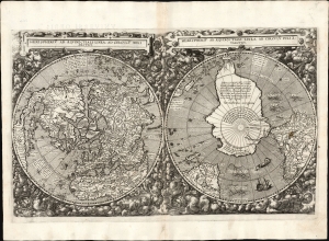
Hemispheriū Ab Aequinoctli Linea, Ad Circulū Poli Arctici / Hemispheriū Ad Circulū Poli Ātarctici.
$62,500.00
Acquire
- Digital Map Information
- Suitable for large format printing
- DPI: 600
- File Size: 26.2 mb
- File Type: TIFF
- # of Files: 1
- ICC color profile embedded
- Delivered instantly via download link
This is Cornelis De Jode's rare 1593 double-polar projection map of the world. It is among the most striking early world maps and among the earliest to introduce the double hemispheric polar projection. Moreover, as a competitor to Ortelius' cartography, it is the sole obtainable map to preserve the innovative Guillaume Postel/Antwerp Unicum cartography. The map is quite rare, having been published in only a single edition. (more details)
Most unique atlas map of Africa to appear in the 16th century.
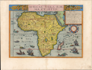
Africae Vera Forma, et Situs.
$11,000.00
Acquire
- Digital Map Information
- Suitable for large format printing
- Full resolution TIFF file
- ICC color profile embedded
- Delivered instantly via download link
This is Cornelis De Jode's superb, rare map of Africa, printed in a single edition of 1593. It is the most unique atlas map of Africa to appear in the 16th century, being the only such based on Petrus Plancius' 1592 wall map of the world. (more details)
First full-size folio map of North America.
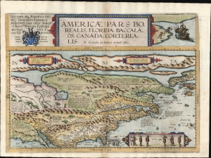
Americae Pars Borealis, Florida, Baccalaos, Canada, Corterealis.
$37,500.00
Acquire
- Digital Map Information
- Suitable for large format printing
- Full resolution TIFF file
- ICC color profile embedded
- Delivered instantly via download link
This is Cornelis De Jode's rare map of North America, printed in a single edition of 1593. The first full-size folio map specifically of North America, it was among the updated maps added to the De Jode atlas specifically to compete with Ortelius' Theatrum Orbis Terrarum. To this end, it combined cartographic information from current sources with a level of decorative flourish that had not yet appeared in any atlas. In the case of this map, Cornelis focused on a part of the world omitted from the elder De Jode's 1578 atlas. (more details)