
Jode, Cornelis De (sold)

Cornelis de Jode (1568 – October 17, 1600) was an Antwerp cartographer, engraver and publisher, He was the son and heir of Gerard de Jode, also a cartographer and publisher. Cornelis studied science at Academy of Douai, but it can be understood that his main education in the trade was at the hands of his father. On his father's death in 1591, Cornelis de Jode took over the work on his father's atlas, Speculum Orbis Terrarum. This had enjoyed publication in a single edition of 1578, overshadowed by the competition posed by Abraham Ortelius' (1527 - 1598) Theatrum Orbis Terrrum. Cornelis published a second edition, to which he added many updated maps to bring the work up to date with its competition. Despite the improvements brought to the atlas, both aesthetic and geographic, De Jode was unable to break Ortelius' grip on the market and there were no further editions of the atlas. After his death, the engraving plates were sold to Ortelius' executor Johannes Baptista Vrients (1552 - 1612), who was continuing to publish the Theatrum. Vrients would utilize several decorative plates from the Speculum, but the complete work and its maps were not published again - likely they were destroyed by Vrients to keep them from competing with his editions of the i>Theatrum.
Rare, Distinctive World Map with a Unique Projection.
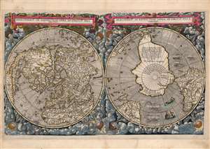
Hemispheriū Ab Aequinoctli Linea, Ad Circulū Poli Arctici / Hemispheriū Ad Circulū Poli Ātarctici.
sold
- Digital Map Information
- Suitable for large format printing
- Full resolution TIFF file
- ICC color profile embedded
- Delivered instantly via download link
This is a beautiful example of Cornelis De Jode's 1593 double-polar projection map of the world. It is among the most striking early world maps, and among the earliest to introduce the double hemispheric polar projection. Moreover, as a competitor to Ortelius' cartography, it is the sole obtainable map to preserve the innovative Guillaume Postel / Antwerp Unicum cartography. The map is moreover exceedingly rare, having been published in only a single edition. (more details)
Published in only one edition.
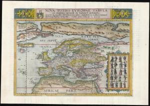
Nova Totius Europae Tabula.
sold
- Digital Map Information
- Suitable for large format printing
- Full resolution TIFF file
- ICC color profile embedded
- Delivered instantly via download link
This is Cornelis De Jode's rare map of Europe, printed in a single edition of 1593. It was among the updated maps added to the De Jode atlas specifically to compete with Ortelius' powerhouse Theatrum Orbis Terrarum. To this end, it combined cartographic information from the most current sources with a level of decorative flourish that had not yet appeared in any atlas. It also presented its subject with a broader focus to incorporate newer information about the northern parts of the world not present on the elder De Jode's map. (more details)
One of the first dedicated maps of South America, and the first to hint at the location of El Dorado.
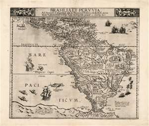
Brasilia et Peruvia.
sold
- Digital Map Information
- Suitable for large format printing
- Full resolution TIFF file
- ICC color profile embedded
- Delivered instantly via download link
This is Cornelis De Jode's 1593 map of South America, the second, full-size map of the area to appear in an atlas, predated only by the 1578 map produced by his father, Gerard De Jode. This rare map, printed in a single edition, outstripped contemporaneous efforts by De Bry and Ortelius in terms of accuracy and beauty. The map covers from Central America and the Caribbean to embrace all of South America; beyond the Strait of Magellan Tierra del Fuego appears, not as a small island or archipelago but extending into a massive 'Terra Australis.' The Amazon River is shown, along with the notation that its denizens practiced cannibalism (Vespucci's sensationalistic description to this effect had long legs; note also the cannibal scene adorning Brazil.) (more details)