
Le Clerc, Jean

Jean Le Clerc (1560 - 1621) was a French bookseller, engraver, and publisher active in Paris during the late 16th and early 17th centuries. Le Clerc, along with Maruice Bouguereau pubslihed the 1594 Theatre Geographique du Royaume de France, was subsequently republished in several editions. Le Clerc also commissioned the Dutch cartographer Jodocus Hondius to compile a world map and several continent maps to accompany later editions of the atlas. The Theatre Geographique du Royaume de France was issued in 1620, 1621, 1622, 1626, and 1631. Most editions were published posthumously Jean Boisseau, who acquired the map plates from Le Clerc's widow. Most likely there was also an unrecorded 1633 issue. Le Clerc should not be confused with another publisher and biblical scholar of the same name active in the late 17th and early 18th centuries.
Early map of Dombes, one of the best water-bird hunting regions in France.
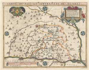
Carte du Pais et Souvrainete de Dombes.
$500.00
Acquire
- Digital Map Information
- Suitable for large format printing
- DPI: 300
- File Size: 10.8 MB
- File Type: ZIP / TIFF
- ICC color profile embedded
- Delivered instantly via download link
This is a beautiful 1617 map of the Dombes region in southeast France by Mathias Mareschal. Oriented with north on the left, the map covers the then principality of Dombes from Montbellet and Pont-de-Voux south as far as the city of Lyon. Lyon, famous for its ... (more details)
Mapping Gascony.
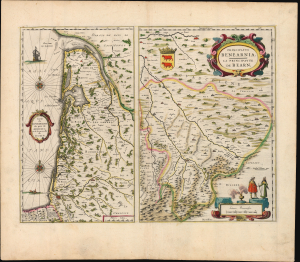
Carte du Bourdelois, du pais de Medoc, et de la prevosté de Born./ Principatus Benearnia. La Principaute de Bearn.
$450.00
Acquire
- Digital Map Information
- Suitable for large format printing
- Full resolution TIFF file
- ICC color profile embedded
- Delivered instantly via download link
This is Willem Blaeu's 1631 map of the Basque country of Gascony in southwestern France, including the wine country of Bordeaux and Medoc. It is printed along with a map focusing on the Principality of Béarn, also part of the Duchy of Gascony. The region is now the western part of Nouvelle-Aquitaine, mainly the départements of Gironde, Landes, and Pyrénées-Atlantique. (more details)